Dasler Pinnacles, North Ridge

I had my doubts about this trip. Much uncertainty regarding the access, timing and weather. It turned out to be the perfect weekend away, and my first taster of a “multi-sport” adventure. With bikes to speed things up, we achieved our objective and made it door-to-door within 48h. Message for the gpx file as can’t upload to the website.
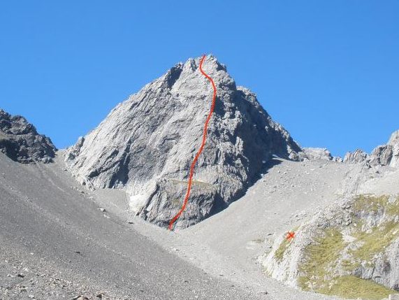

  • Grade: II, 1+
  • Time: 20-30min bike to Monument Hut (around 5km, depending on how far your car can take you along the 4WD track). 45 min bike to Red Hut (5.5km). 30 min bike to trail head of Dasler Pinnacles trail (4.5km). 7-8h from trail head to summit and back; time on ridge was around 2h.
  • Equipment: can be done in trail runners/approach shoes. We took a rope, helmets and tat only. No rack. We took lightweight crampons just in case as there had been an unseasonable dump of snow in the weeks prior but there was no snow on the route and minimal in the surrounds.
  • Season: Summer/early Autumn to ensure rock is dry. Best to go when dry since significant rainfall in the days prior will have increased the river level, making your crossings spicier.
  • Team: Maria, Shona, Younes 3-5/03/2023
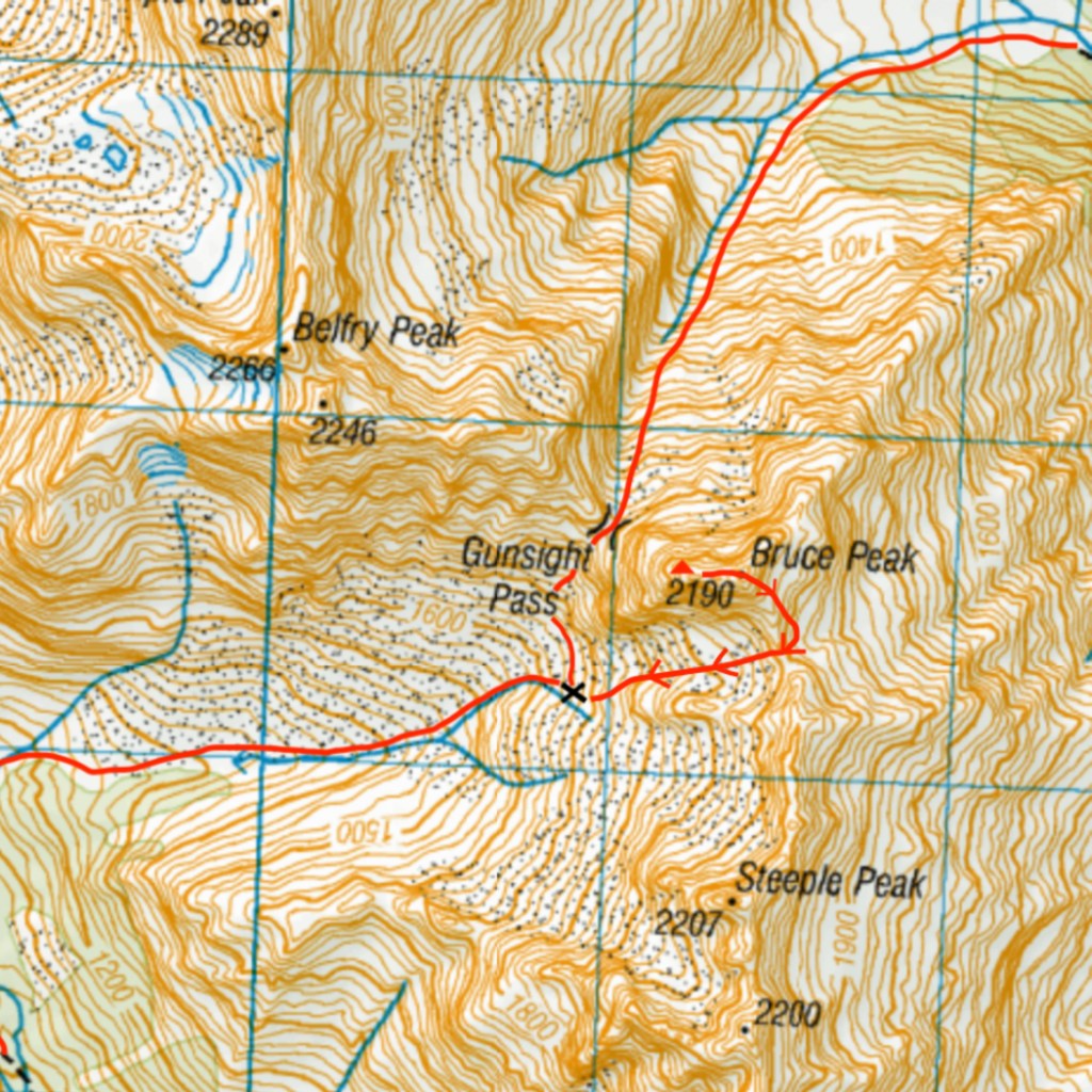
Access

The Hopkins Valley is very popular with 4WD-ers and hunters alike, so there is a decent 4WD track along the valley floor. If you have a 4WD – or a high clearance vehicle you can drive to Monument Hut. If you’re happy fording then you could drive the whole way to the start of the Dasler Pinnacles trail. We parked 2km from the road end and biked around 5km along easy road to Monument Hut.

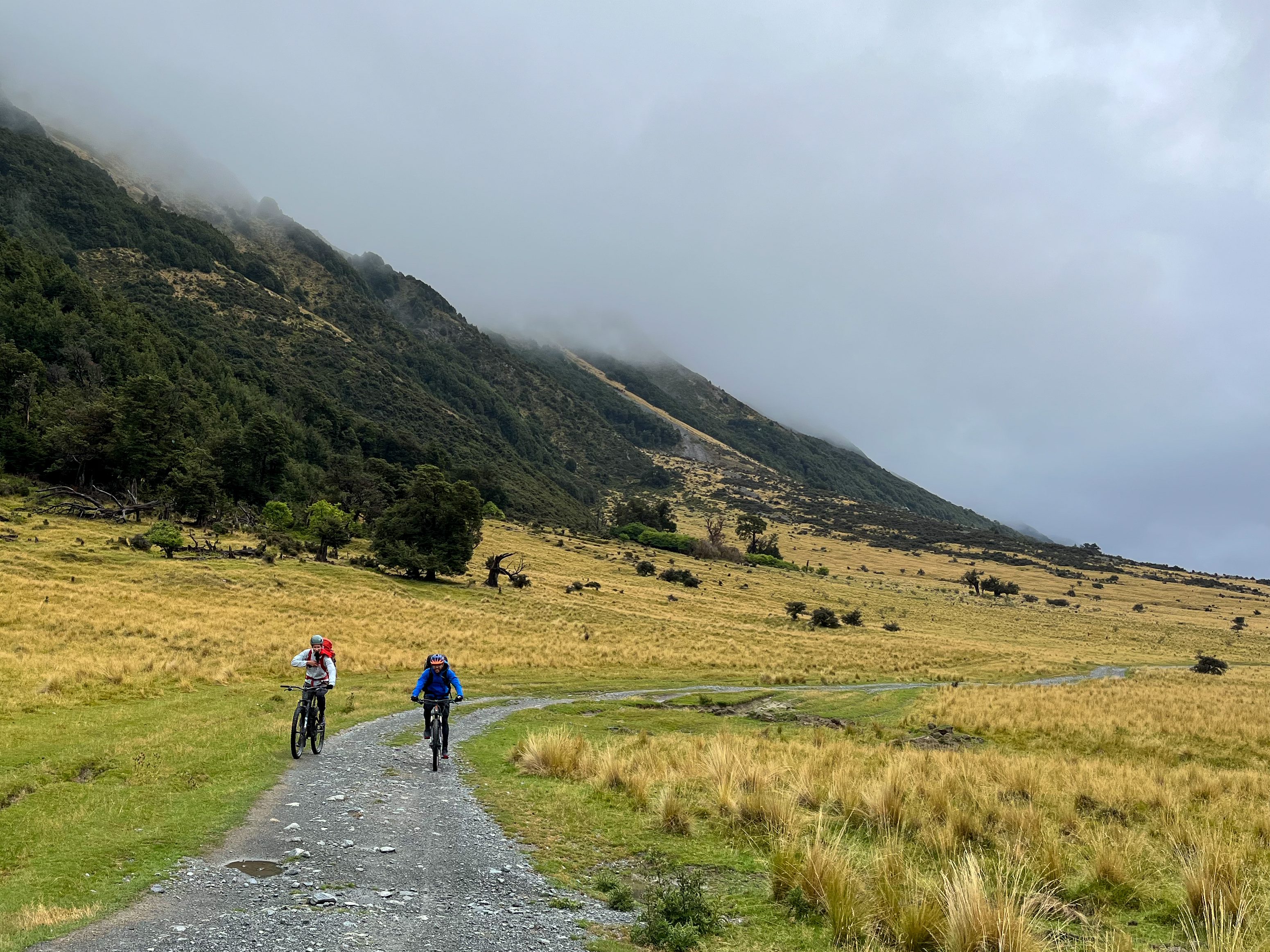
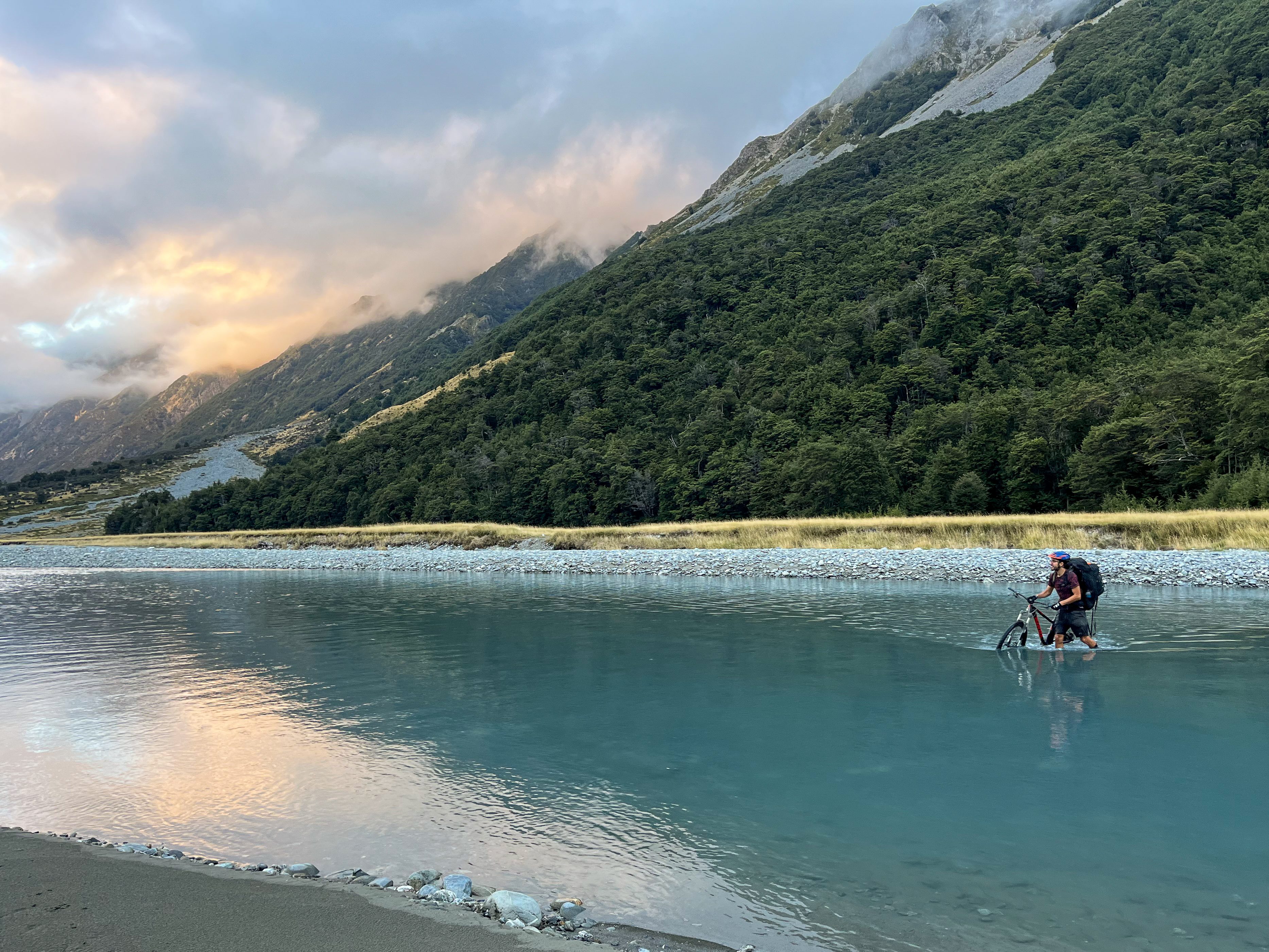
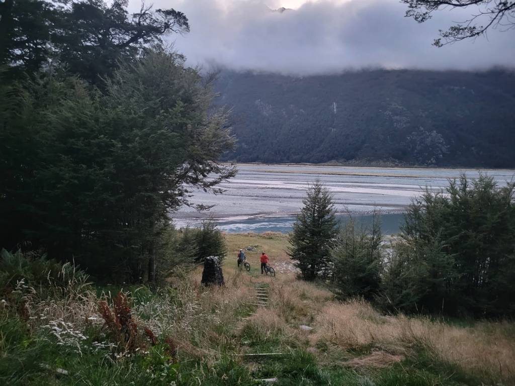
From Monument Hut, don’t follow the trail into the forest – it is possible to bike but the track makes you gain elevation unnecessarily. Instead cross the river immediately in front of the hut (1st of many crossings so don’t be precious about your feet). There are a few 4WD tracks – one that takes you up the river’s true right then cuts across to Red Hut; the other goes diagonally across towards Red Hut on the river’s true left. The track up the river’s true right was better formed and easier to ride.

Great in-situ chain for a steep section on the Dasler Pinnacles trail – was happy to yard on it.

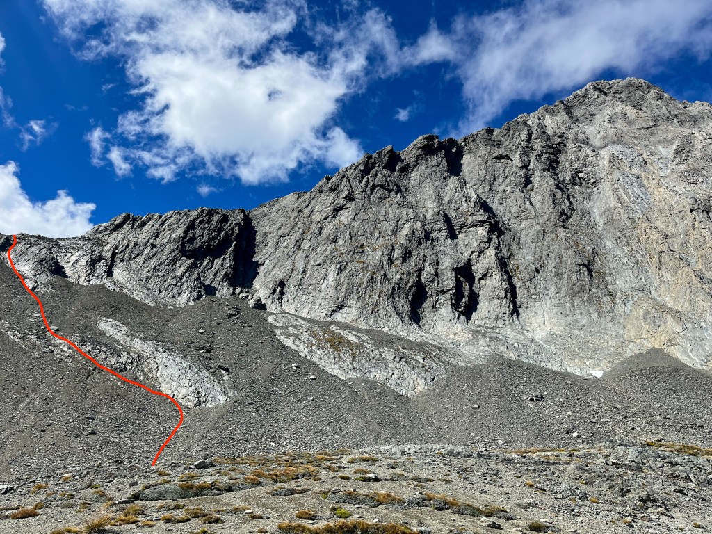
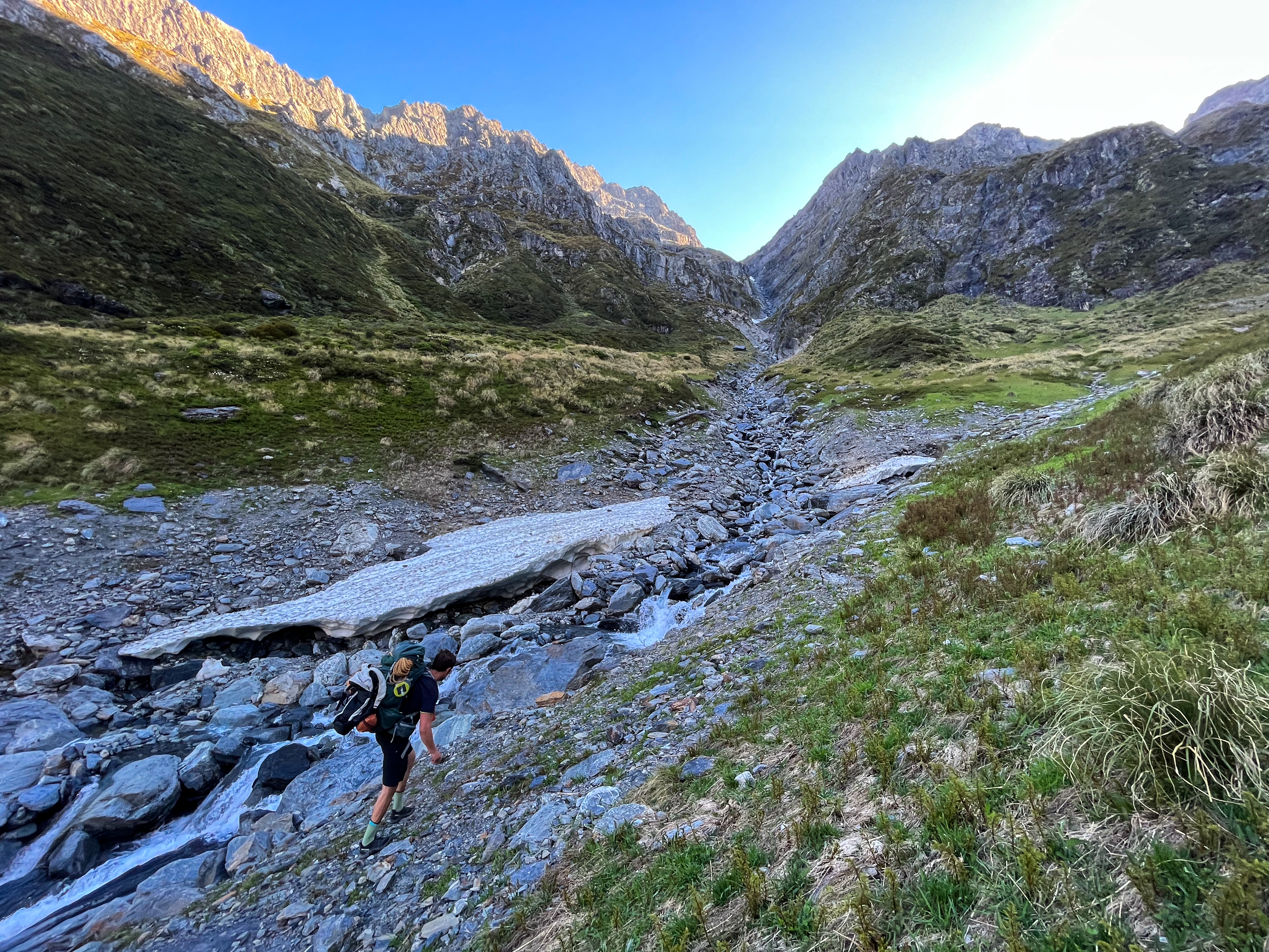
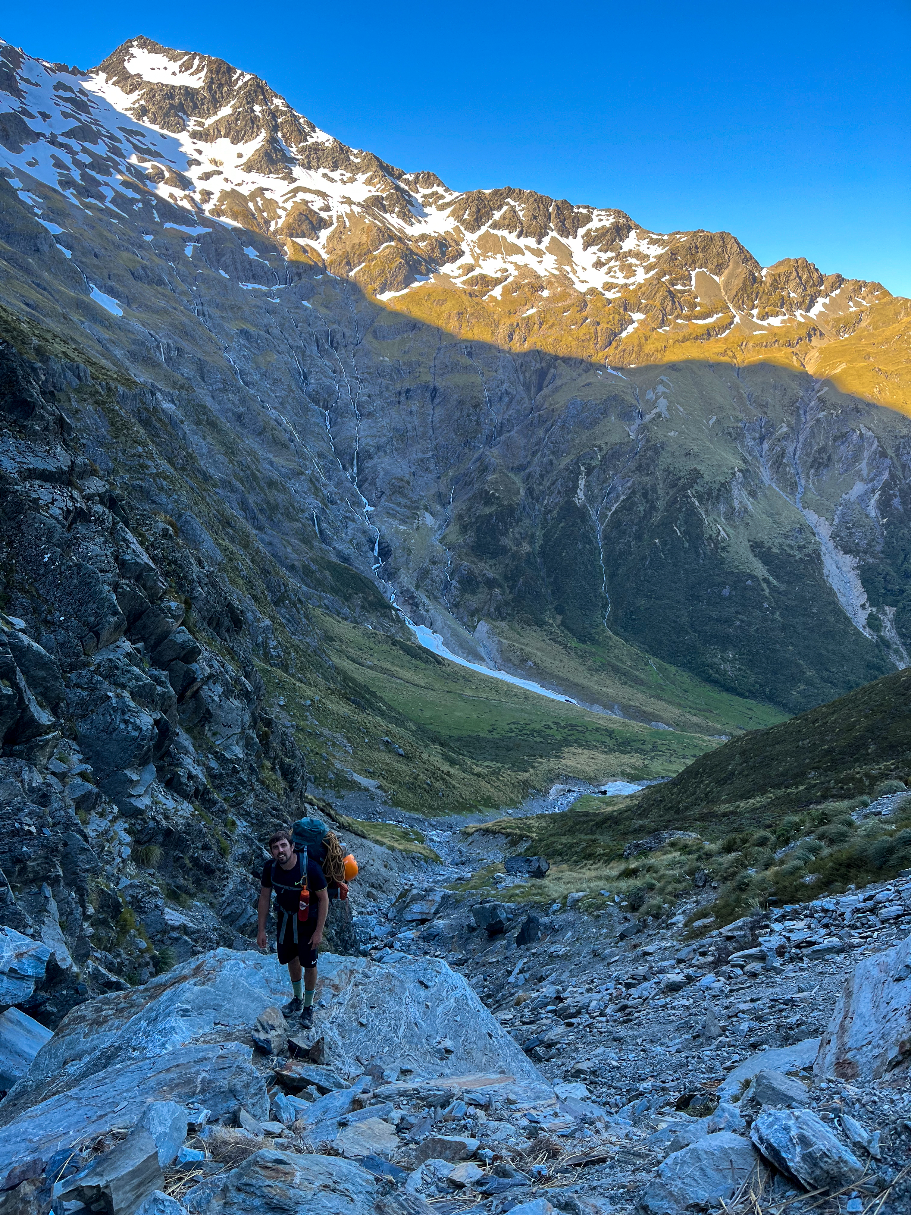
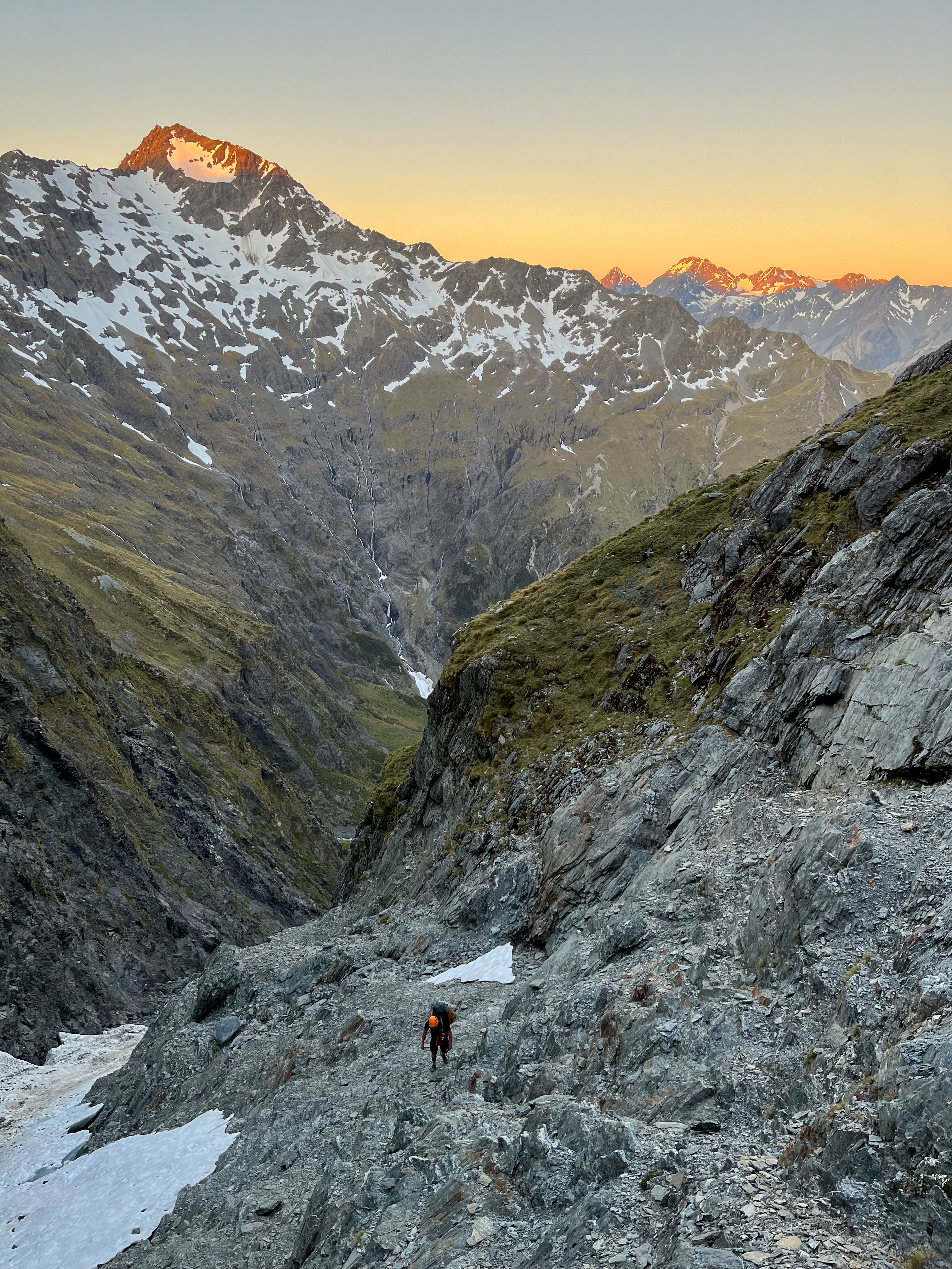
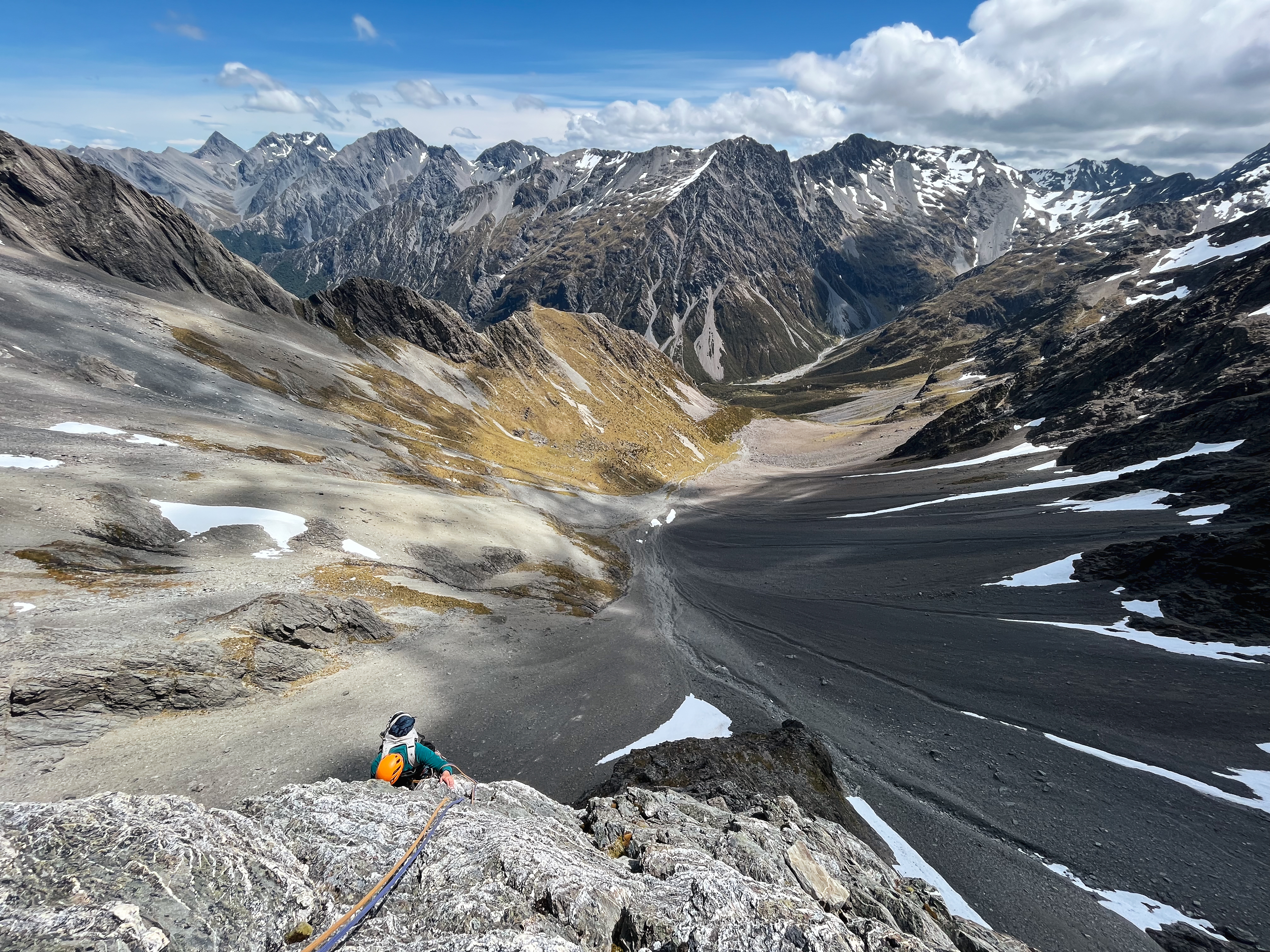
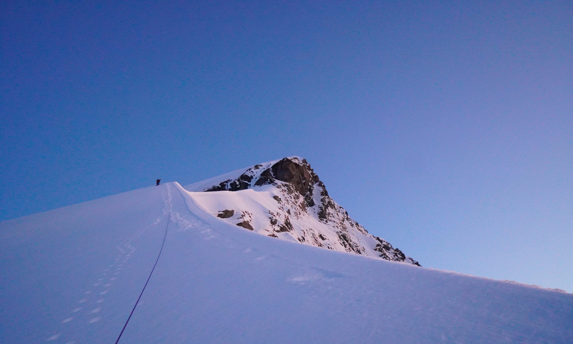
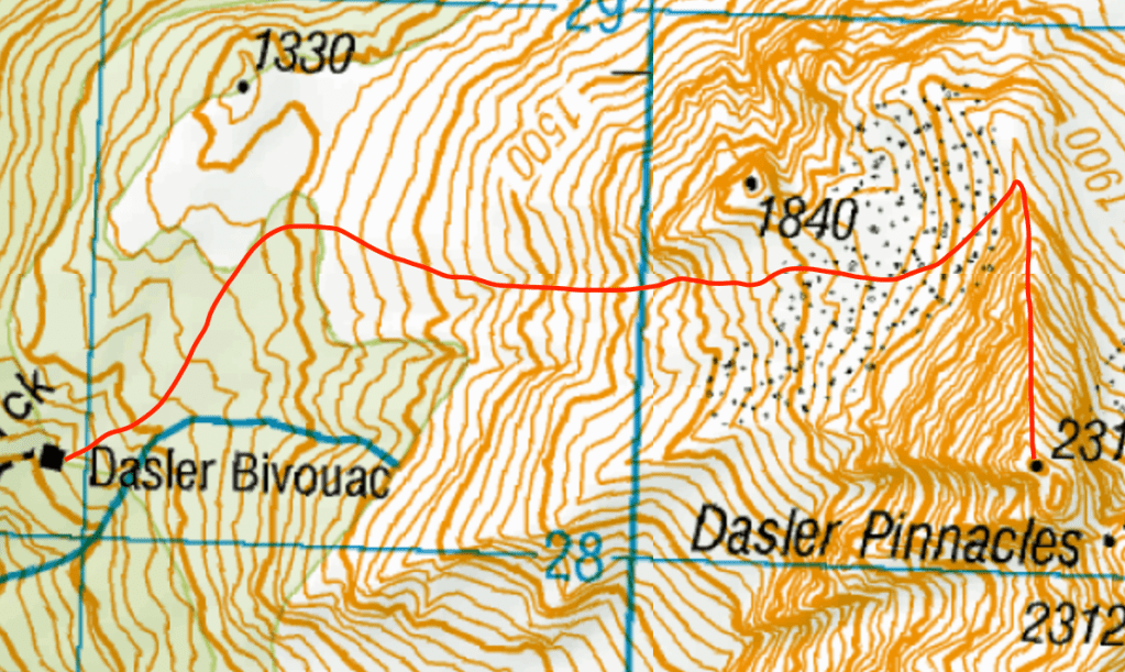
From Red Hut (great place to stash any sleeping gear etc. that you won’t need for the rest of the day), we biked along an easy 4WD track, stashed the bikes and hiked up to Dasler Biv. Trail is well marked and easy to follow. Follow the trail to the left of the Biv; soon you’ll break out of the beech forest into scrub. Navigate the bluffs, aiming for the base of the N ridge. There is a decent camp spot with water at the point 1840; the views would be glorious and we wished we were staying the night up high. Scramble up the scree, hugging the rock face, up to the base of the N ridge. We stashed some more things under rocks to make our climb even more light & fast.
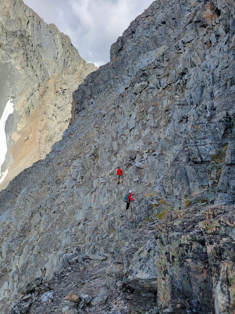
climb

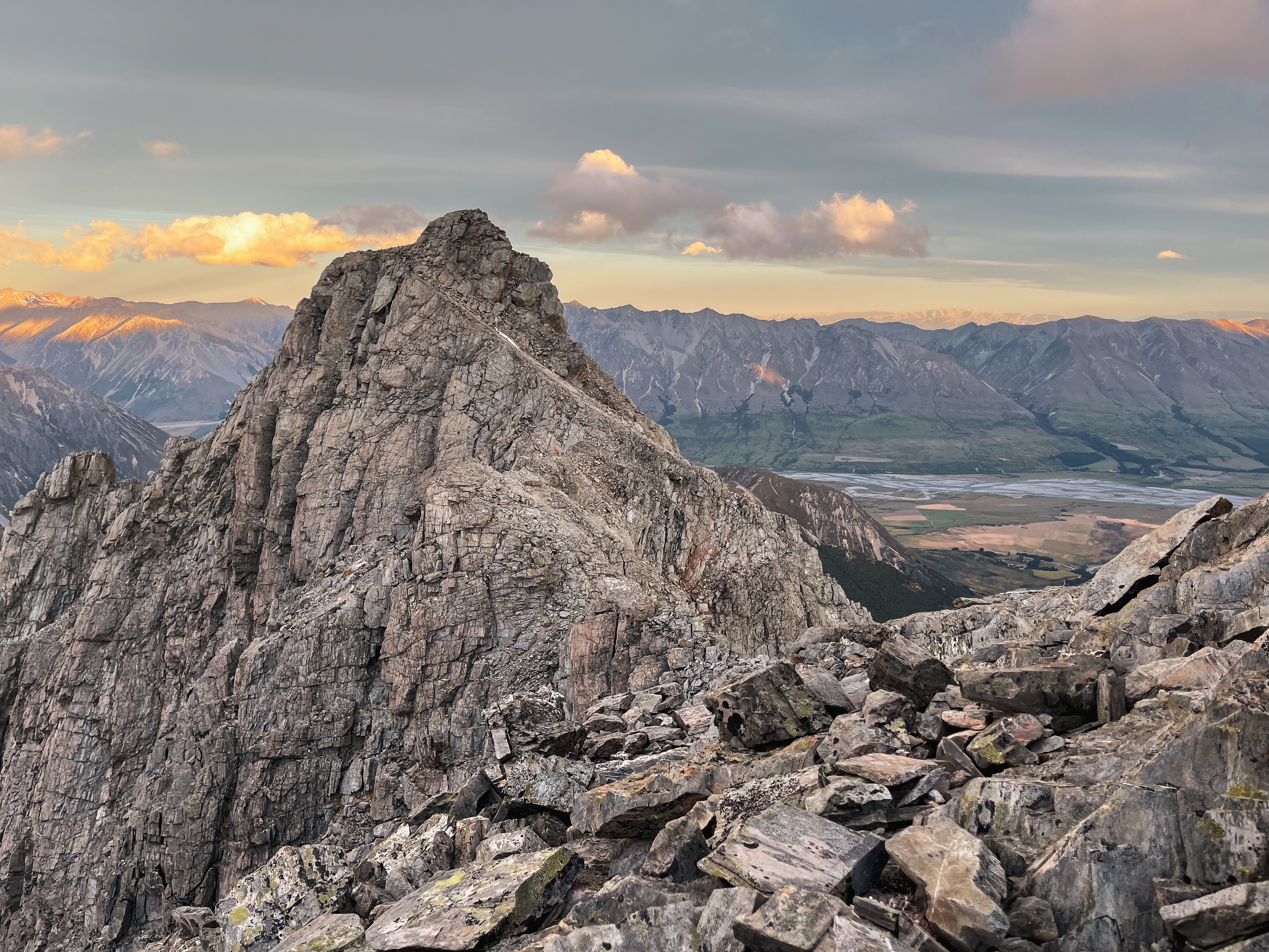
Fun scramble to the summit; none of it felt committing – if ever there is a steeper section then there are options to sidle around. The rock (?Greywacke) was pretty decent, peaking interest in the other routes on the NW face. Down climb the same way. 2-3h return.

We boosted down, quick cuppa at the Biv, then some respite for the feet as we biked into Red Hut for the night. We just missed the heavy rain, and woke up to snowy mountain tops the next morning. Drove home in time for dinner – a very achievable weekend trip from Christchurch!

Bruce Peak, Butterfly Buttress

Come on a trad multi-pitch climb, she said. It’ll be fun, she said… This was Jack’s first trad/alpine climbing experience and the first on which I lead by myself. The climbing was easy with a crux of 14, and the rock was decent, however a leisurely pace meant we were near-benighted as we struggled to find the walk-off in the dark. Route finding in pitch black and 60kph winds… Not advisable!

Moral(s) of the story – need to work on simul-climbing, bring a lighter rack, a single rope would have been fine, 1 bag of car chips to come back to is not enough


  • Grade: 5 IV 500m. Crux grade 14 (Largely sub 14, 10-14). All trad including anchors. Good belay ledges.
  • Equipment: Full trad rack, singles up to #2, full set of nuts. No need for RP/micronuts. 2x 240 slings for anchors. 5-6 alpine draws sufficient including some 120s if confident at the grade – I was only placing 4-5 bits of gear on most pitches. We used 2x 60m half ropes but with long slings a 60m single rope would be fine. We walked off but did come across tat from another party’s rap descent – always a good idea to have some spare tat.
  • Approach time: 4-5h via the North Temple track/Gunsight Pass
  • Climbing time: 12h (we took it v slow, a fast party could climb it in half the time)
  • Season: Best in Summer, for those long days and warm rock. Being on the SW aspect we were largely in shade so layers were appreciated.
  • Team: Maria, Jack 29/12/2022

Approach

Park at Temple Campsite.

Option 1: Walk in/out via N Temple Track. 1.5h along a doc trail – a few landslides along the way make for navigating some fallen trees. Getting up and over Gunsight Pass to the biv spot took 4-5h. I would not want to descend this chossfest, so would not recommend this as a way out.

Option 2: Walk in via N Temple and out via S Temple (9km, 5-6h in and 16km, 6-7h out). This was the route we opted for. Walk out from the biv to the S Temple track required multiple river crossings. Once you hit the doc trail follow the cairns (there are no regular orange markers until you hit S Temple Hut).

Option 3: As per the guidebook/climbNZ, start on N Temple Track then turn off at BZ14 433 141 and head straight up through scrub towards Bruce-Steeple col. Looking up at the dense beech forest, we thought this might be slow going but I’d be open to trying it next time.

We camped on a strip of tussock amongst the scree marked by X at around 1650m. There’s running water right beside it.

X marks the biv spot; Triangle marks route top out. From the triangle marks our descent route. Climb route not shown, see below.

Photo credits to ClimbNZ (https://climbnz.org.nz/nz/si/otago/barrier-range/bruce-pk).
Our route in red, X = biv spot.
The Route

To get to the base of the route, sidle 200m North of the biv spot along the same contour towards Bruce Peak. The climbing starts at the lowest point of the buttress.

P1: (14, 60m) Poor gear. Climbing no harder than a 14 but felt harder as was difficult to protect.

P2: (10, 60m) Very easy scrambling, can be simu-climbed for confident parties. Minimal gear was placed with much better protection than in the first pitch. Finishes over a wide grassy ledge.

P3: (11, 60m) Similar to above. Follow the arete.

P4: (14, 60m) Probably the hardest pitch yet, grade 14 interspersed with easy grassy ledges. Decent gear. Some steeper areas directly up, however can avoid by sidling right.

P5 (13, 60m) Some staunch moves in between easy climbing.

P6-8: (11-13, 60m each) Can stick to the arete but we chose the path of least resistance, going diagonally left which leads you to a rocky platform.

From here we took the rope off and scrambled the last 50m or so up to the top via an easy gully. The true summit lies 100m East of where you top out. It’s easy ground heading to the true summit then you have to navigate ledges down to Bruce-Steeple col. Would have been much easier in the light but doing it with head torch illumination alone resulted in a lot of back/forth. We ended up actually going down the NE face then coming back up the N side of the col. Came across a block that a party had rapped off down the S face – perhaps in the dark as well? Basically, I’d leave plenty of daylight to figure out the descent. Would expect it would take 1-2h to get back to camp.

All in all a great 3 day trip, and awesome to be able to share in a friend’s first trad climb. A little dose of suffering is good for the character anyway…

Addit: struggling to upload the gpx file at the moment. Just comment if you want it and can send through directly.