
More widely known for ski touring, the Arrowsmith range is much less trafficked for its Climbing routes. We decided to check the area out mid February, savouring the last of the summer. It certainly is a beautiful area with striking peaks piercing the skyline, a downscaled version of Patagonia? Rock quality being much more questionable, of course. Wouldn’t be New Zealand without a bit of character building choss.
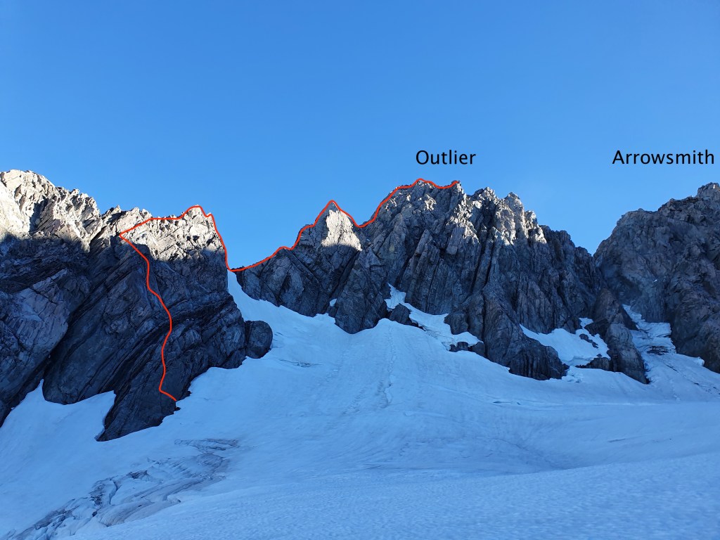
We didn’t actually finish the full route up Mt Arrowsmith (despite it being described as “the best part” by ClimbNZ), turning around instead at Outlier (unnamed on NZ topo at 2723). It was still a stunning climb – would just take caution on the rock and take plenty of time and tat.
- Grade: 4-, crux 14
- Equipment: 1x full set of cams, range of nuts, 5x alpine draws, 9x 60cm slings, 2x 120cm slings, 1x 60m rope, tat, 1x ice-axe, ATC, microtraxion, crampons (we took lightweight aluminium crampons – Petzl’s Leopard – which were sufficient), avi gear
- Approach time: 4-5h (~13km direct but meanders)
- Climb time: 16h 45min
- Season: we climbed in February, late summer, but could be climbed throughout the summer or as a winter route, bearing in mind the avalanche risk
- Team: Joe, Maria 20-22/2/22
getting there
Drive took just under 3h from Christchurch.
Drive along Hakatere Heron road, past Lake Heron. Turn left onto 4-wheel drive track where you will pass a gate. Park up near the sign/intention book. There are deep ruts in the last 10m leading up to this point so some cars might want to park just shy of the sign to avoid getting stuck.

approach
Well marked trail all the way to the hut with marker posts (grey, not the usual DOC orange) – not to be confused by the tall, orange speargrass!
Bit of bog, minimal bush. Follow the river.
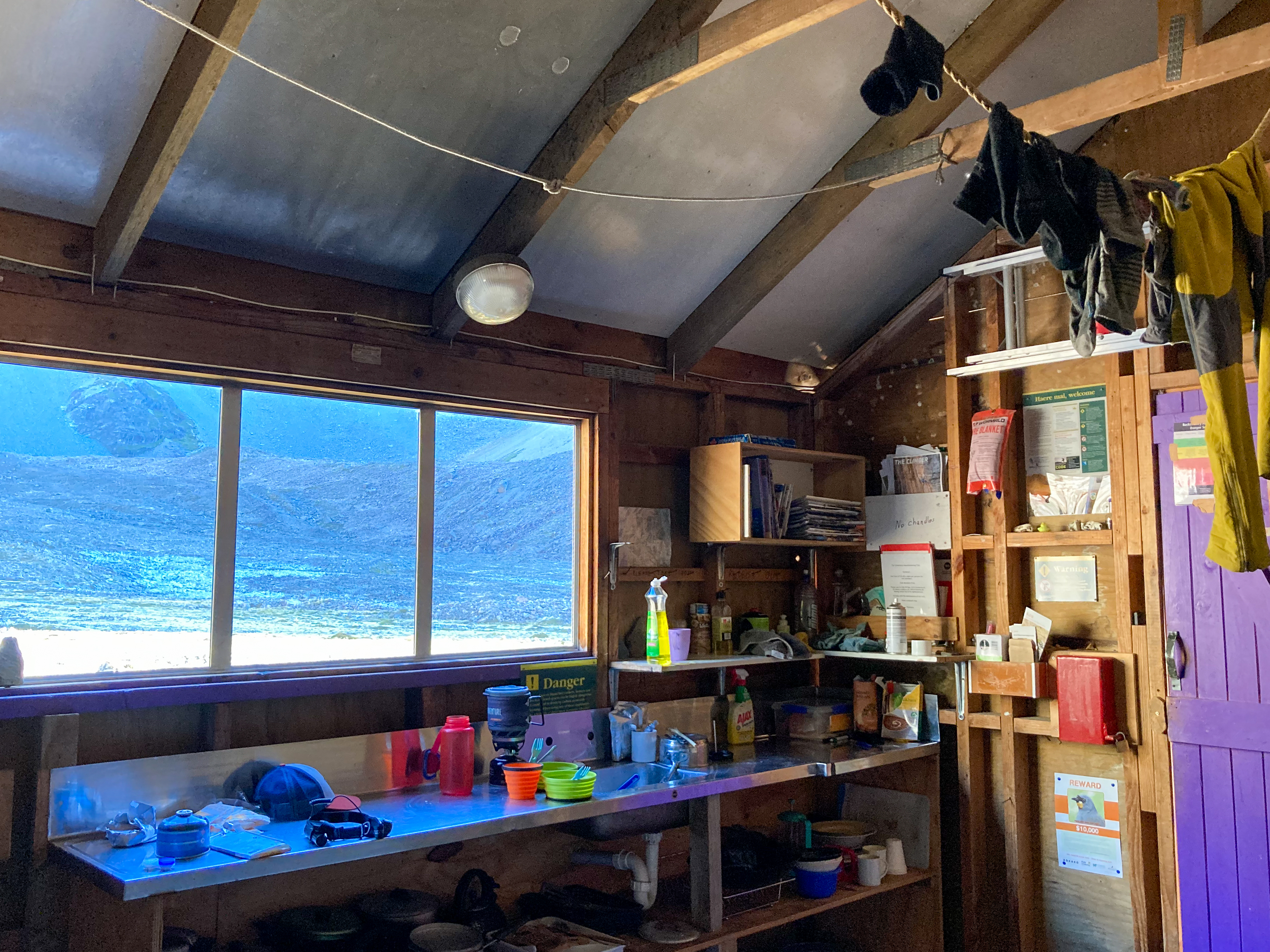
Hut is very easy to spot – hunter green with hot pink door, super distinctive.
Well equipped hut with pots/pans, cutlery, industrial hand sanitiser and hours of reading material from decades old copies of The Canterbury Mountaineer.
Intentions book wrongly stated that “everything is cut off” so we altered our plans – instead of going via the South Cameron glacier, we would attempt the Douglas glacier which was in view from the hut as having minimal snow/névé to travel across.
Happy with plan B, we settled in for an early night at 7.30pm.

climb
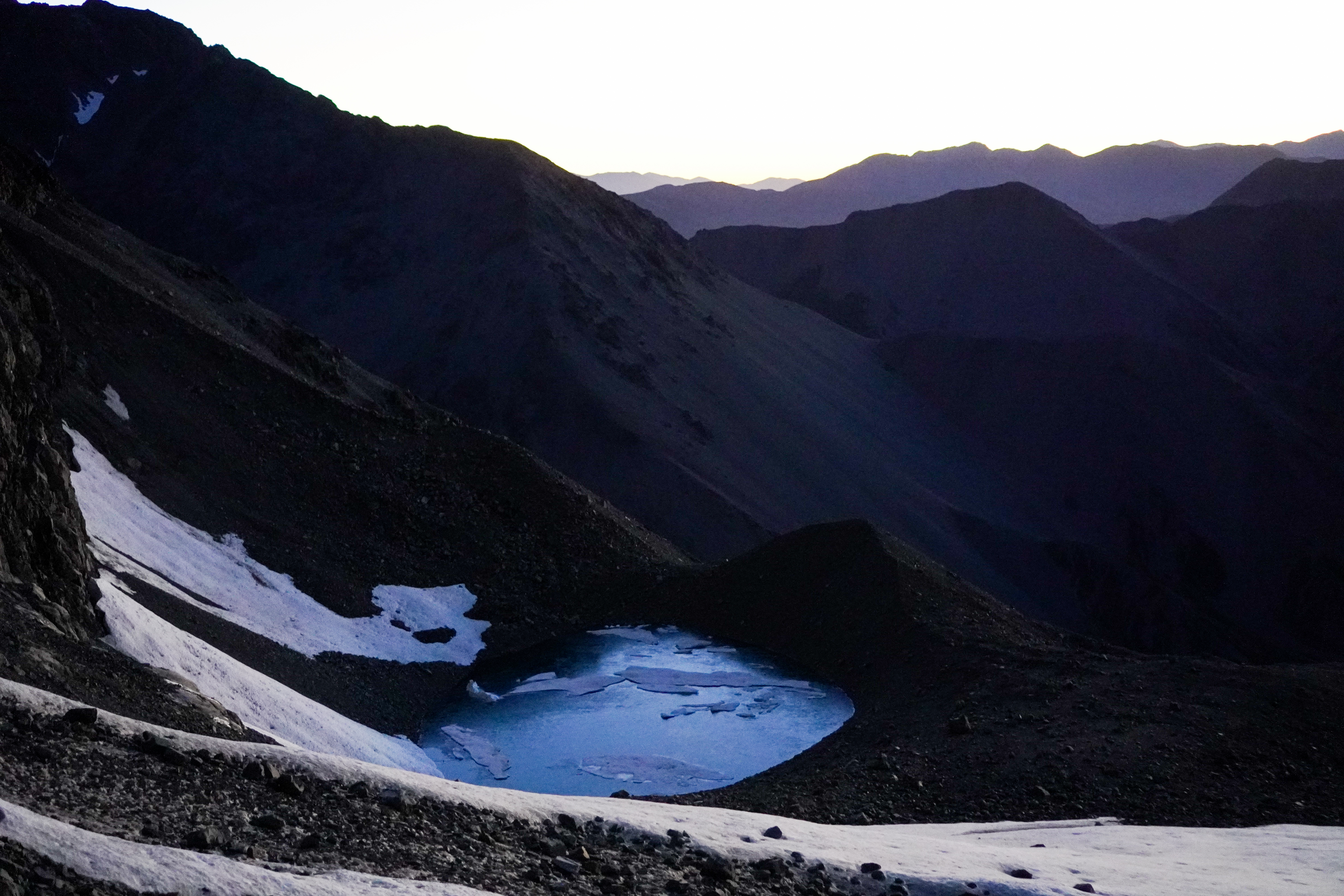
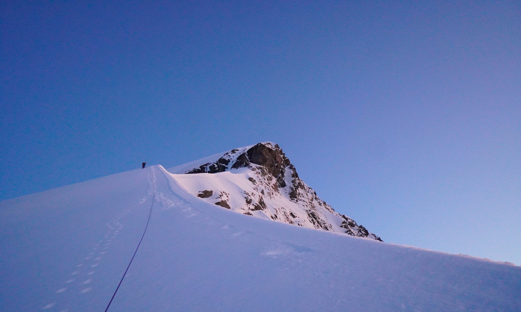
Alarm woke us up at 3am – a solid sleep only briefly disturbed by the sound of Kea claws dancing on the hut roof. Set off by 4am.
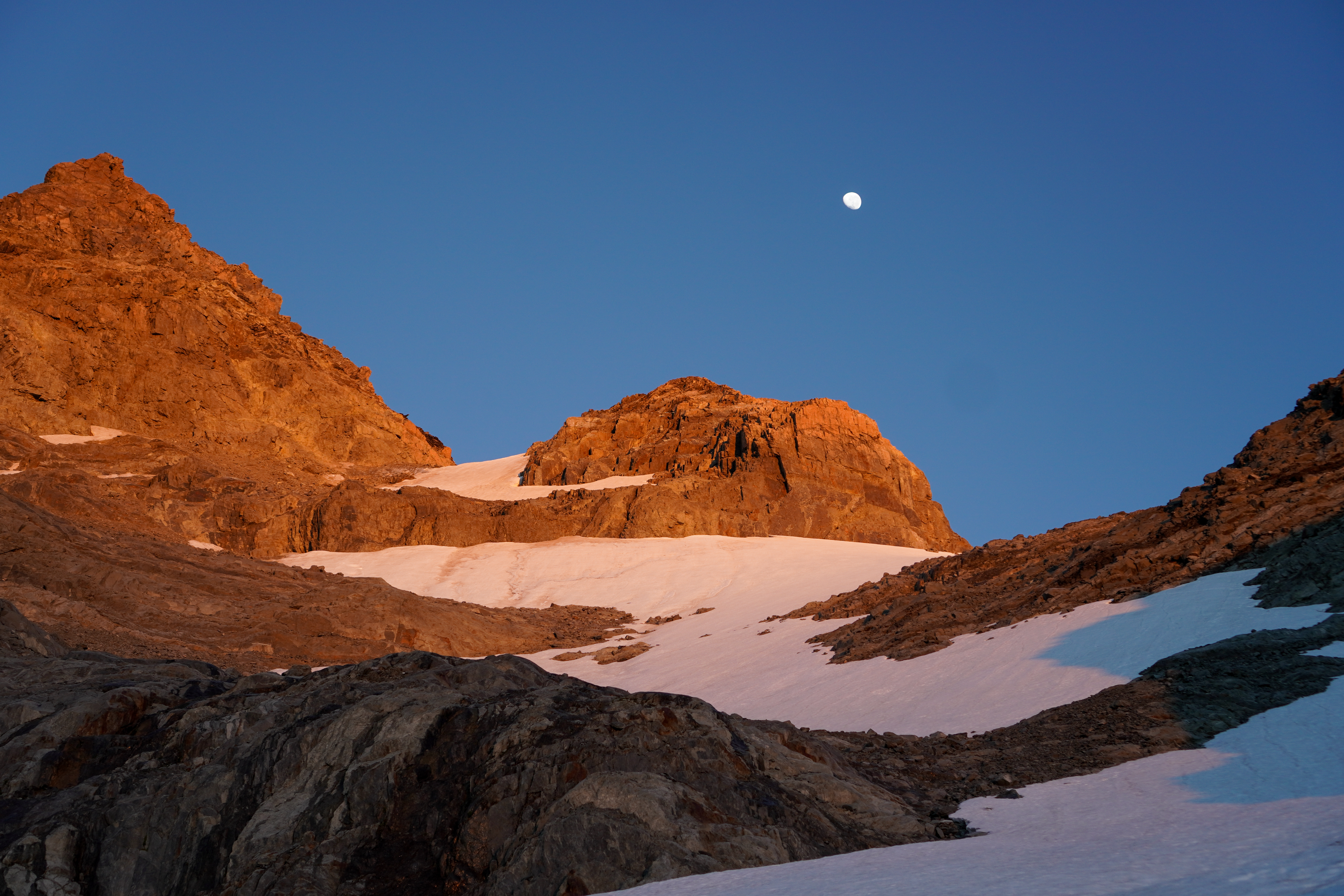
It took us around 3h to get up the moraine onto Douglas glacier and then onto the col just East of East Horn (see topo above). Patchy bits of glacier meant we had to take the crampons on and off a couple of times.
We navigated across the South Cameron glacier, weaving through bands of seracs then accidentally found ourselves amidst them so had to use one cheeky ice screw to get onto firmer ground… Swinging an ice axe in one hand and a pole in the other – a well established technique.

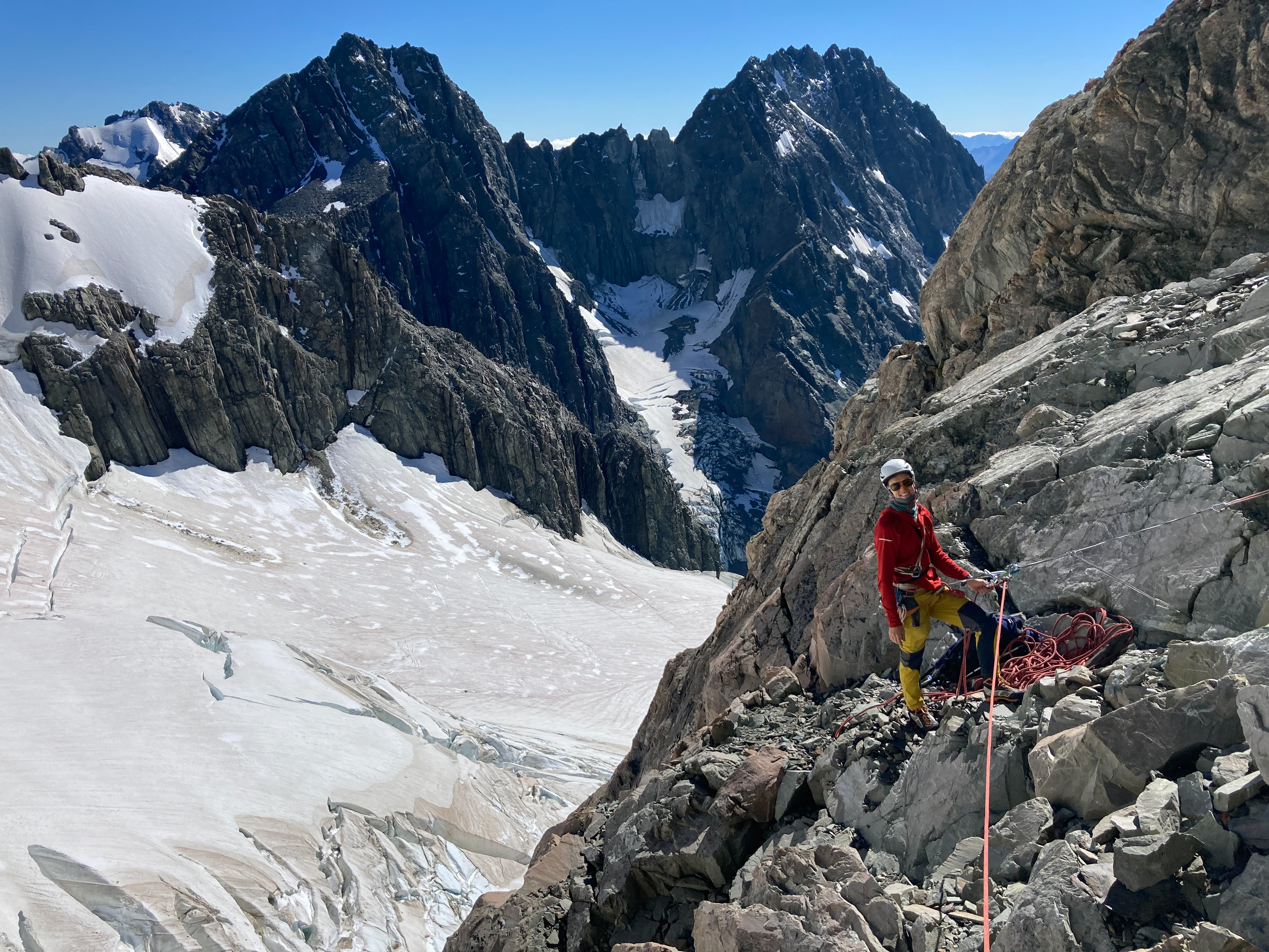
It was not obvious where the base of the route was, but given the crux was 14 we found a starting point that looked reasonable and went with it.

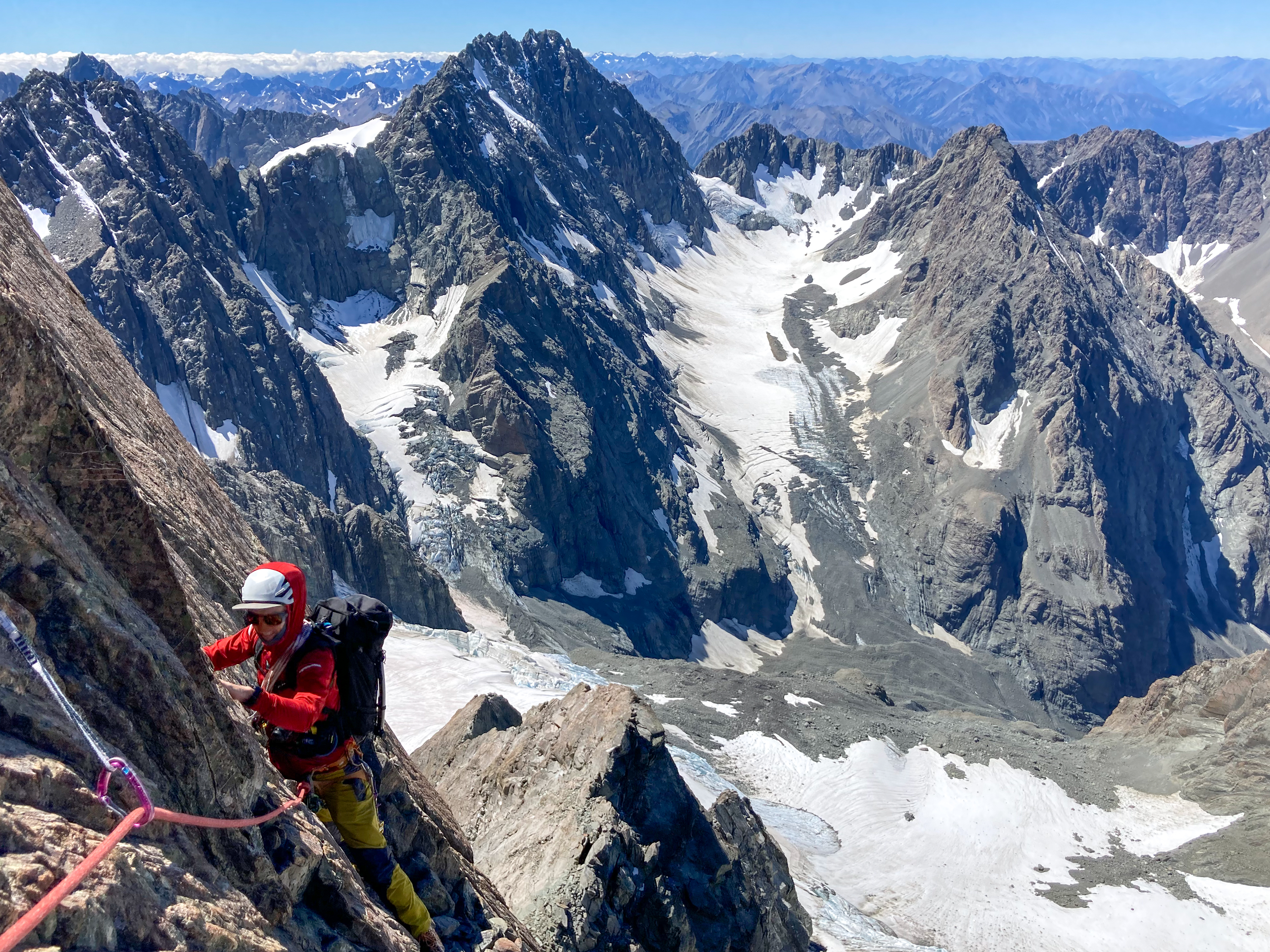
We climbed in our boots, simulclimbing 90% of the time – the ridge is very exposed but the climbing is easy. An epic cheval made for a great photo op but in reality we went along the side of it as the drop off at the other end looked steep.

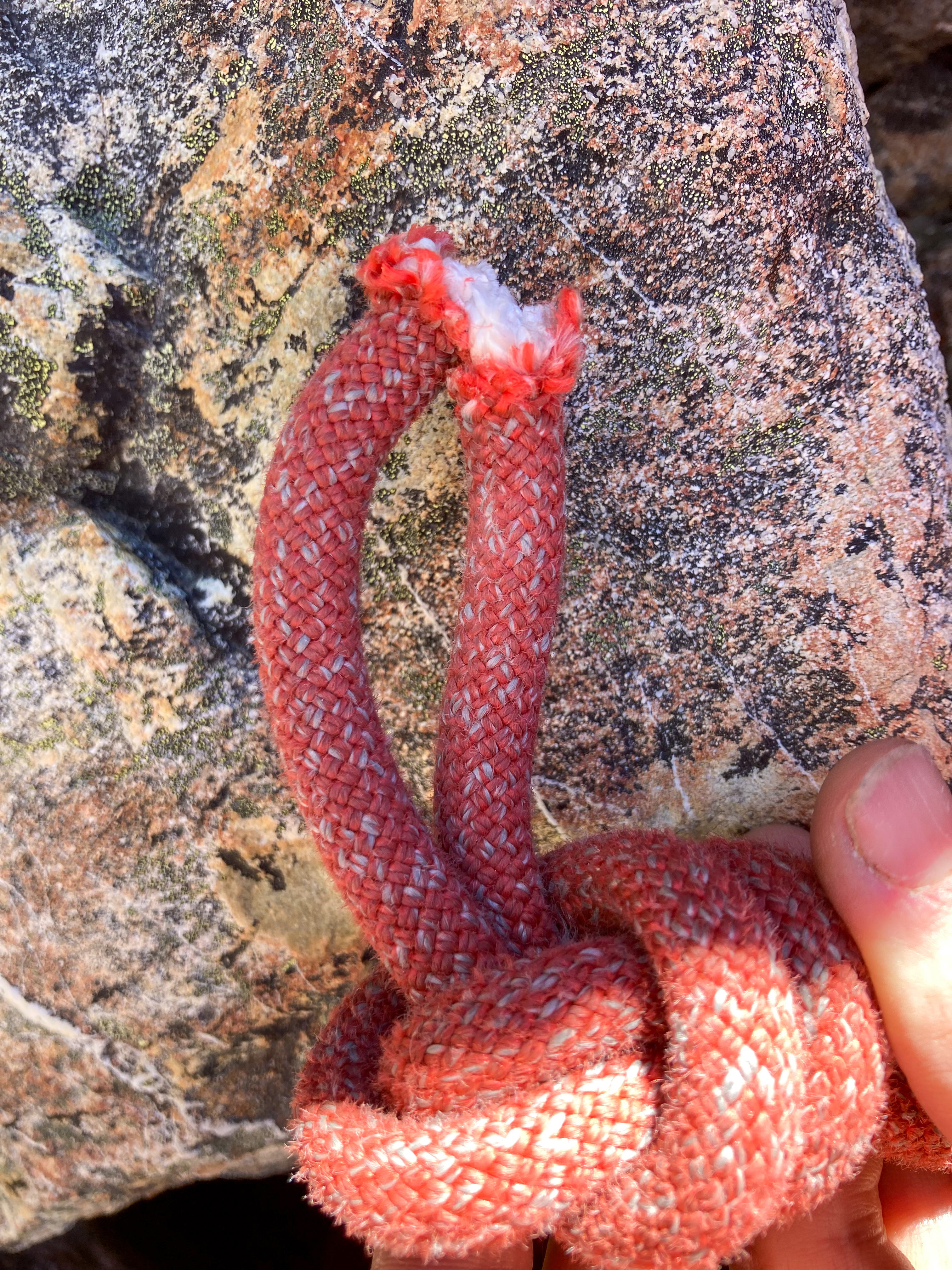
As the rock steepened off we pitched the last 100m to the summit of Outlier at 2723m.The original route describes going across to Arrowsmith but spontaneous rock fall around us did not fill us with much enthusiasm to stay for long on the ridgeline. We also noticed a core shot in the rope at around the 50m mark – presumably from a rock falling onto it earlier in the day. Definitely time to turn around. Perhaps the ridge would be more appealing in Winter..!
Descent
We cut the rope, tied it and rapped off. There were decent spikes to rap off the whole way. We made 3x 25m raps then walked back to a snowy col.
We could see the entire S Cameron glacier from the climb – it wasn’t cut off so we chose to walk out this way.
The moraine was reasonably easy to walk down. Stay high until you reach the grassy buttress otherwise you’ll get bluffed out. Once at the grassy buttress there is a faint path in the moraine which you can follow down. It turns into an obvious path all the way back to the hut. We got back just as we were losing daylight. Boots off, salty soup and a big feed before bed.
Next day we walked out faster than the way in – lighter packs and we had no lunches so that made for motivation to GTFO!