
An excellent multipitch ice route. The ice tends to get fatter the higher you go so if its on at the start you can be pretty confident its only going to get better.
- Grade : 5 . 400m of ice climbing, mostly WI3 but with short sections of WI4
- Equipment : We had 2x 70m half ropes, 12 screws with long runners, small rock rack (4 cams and small selection of nuts) which we didnt need but would be useful if thinner conditions. 2 x snow stake. Tat for V threads. Skis make approach much easier.
- Approach : 1 hour from Kelman hut on skis. 2 hours back. Less from Tas Saddle
- Climb time : 8.5 hours
- Season : 14/9/2021. Sept – Nov is prime season. Before this likely to be pretty thin
- Team : Joe and Sean Cox
Approach
We got a ski plane up to Kelman hut. By linking up with 2 other skiiers the flight was pretty cheap. One day I’ll walk into the tasman…..but not on this trip.
Skis make getting to and from the route much quicker. Tas saddle hut is significantly closer to the start of the route, but on skis theres only half hour in it. Tas Saddle was full when we went up so we headed to Kelman. Kelman also has the advantage of gas and cookers so you dont need to bring that stuff up with you, and the seperate kitchen and sleeping areas means you have a bit more chance getting some sleep and not getting woken up everytime someone wakes up (although on this route your likely to be the first up anyway). It was pretty hectic when we were there, packed to the rafters with every bunk taken and people sleeping on the benches and kitchen floor. Made for great evening chat with everyone in the hut sharing their mission plans for the next day, but made sleeping more challenging. I slept in the bootroom on my airbed which meant I avoided any snoring….but got a rude awakening every time anyone went for a middle of the night pee.

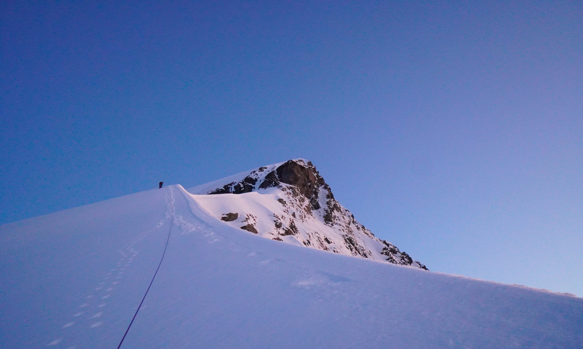
We had gone and checked out the route the day before to make route finding in the dark easier and get an idea of conditions. We left the hut at 03:15 and were starting to climb just as it got light.
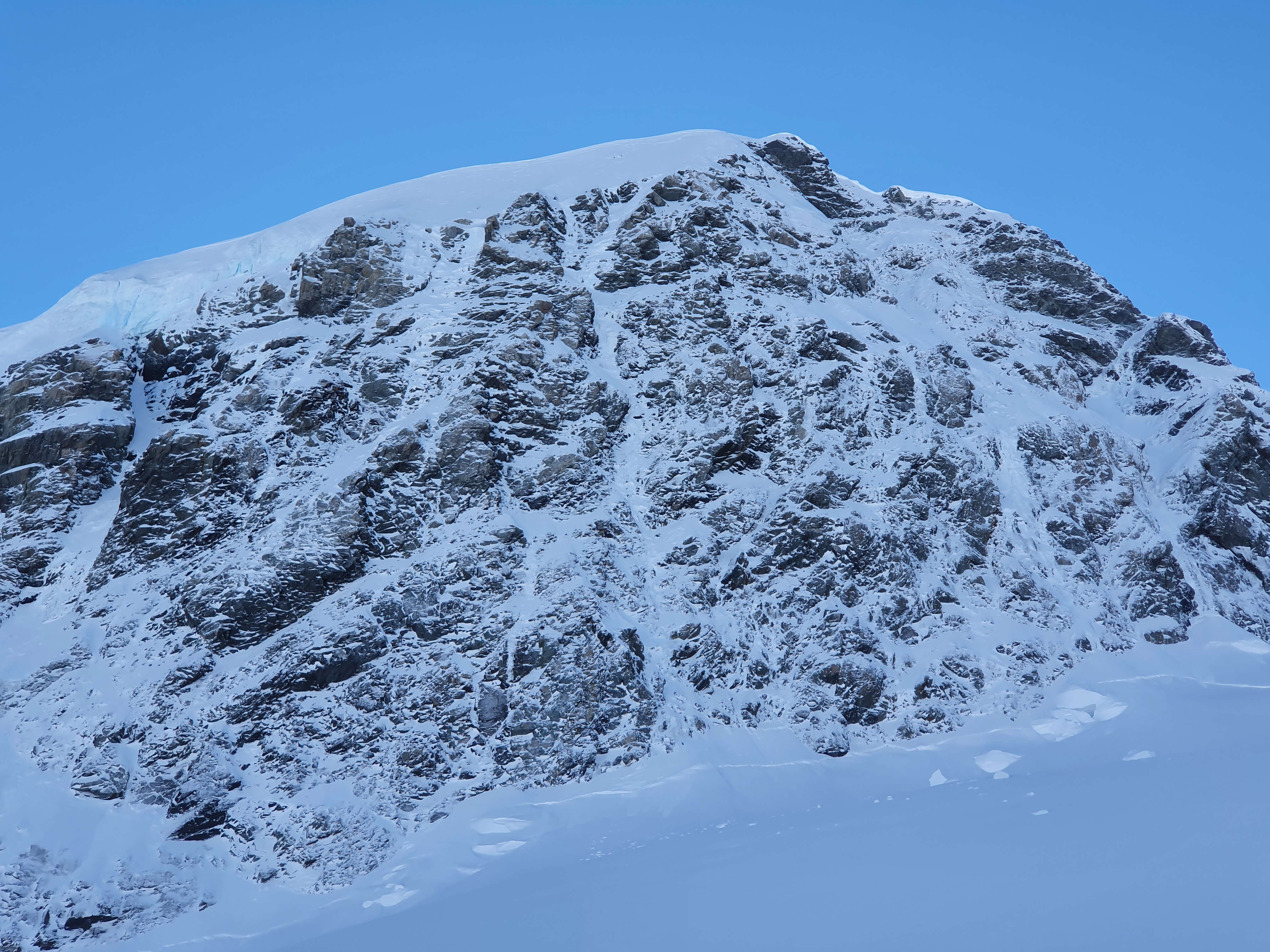
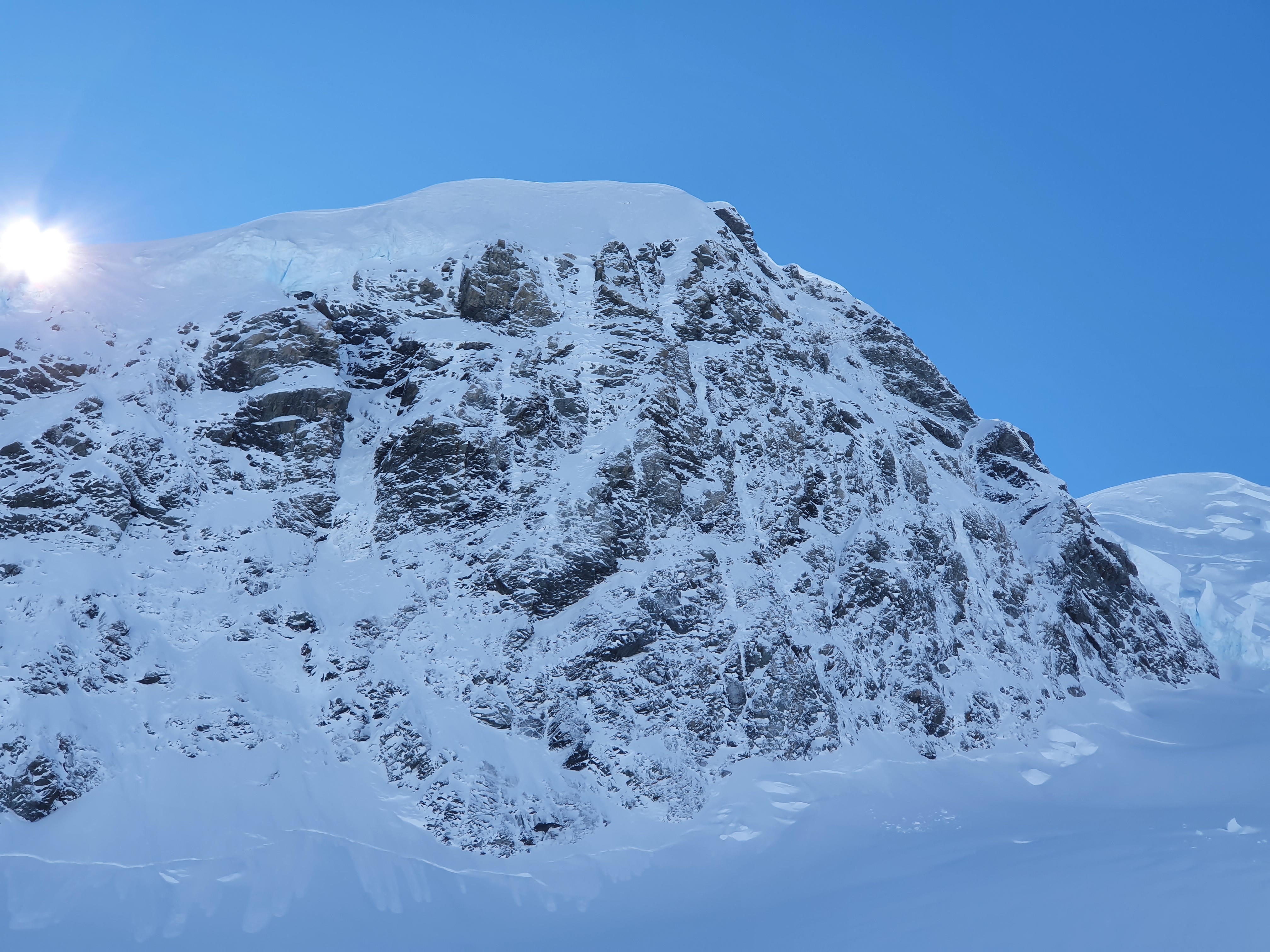
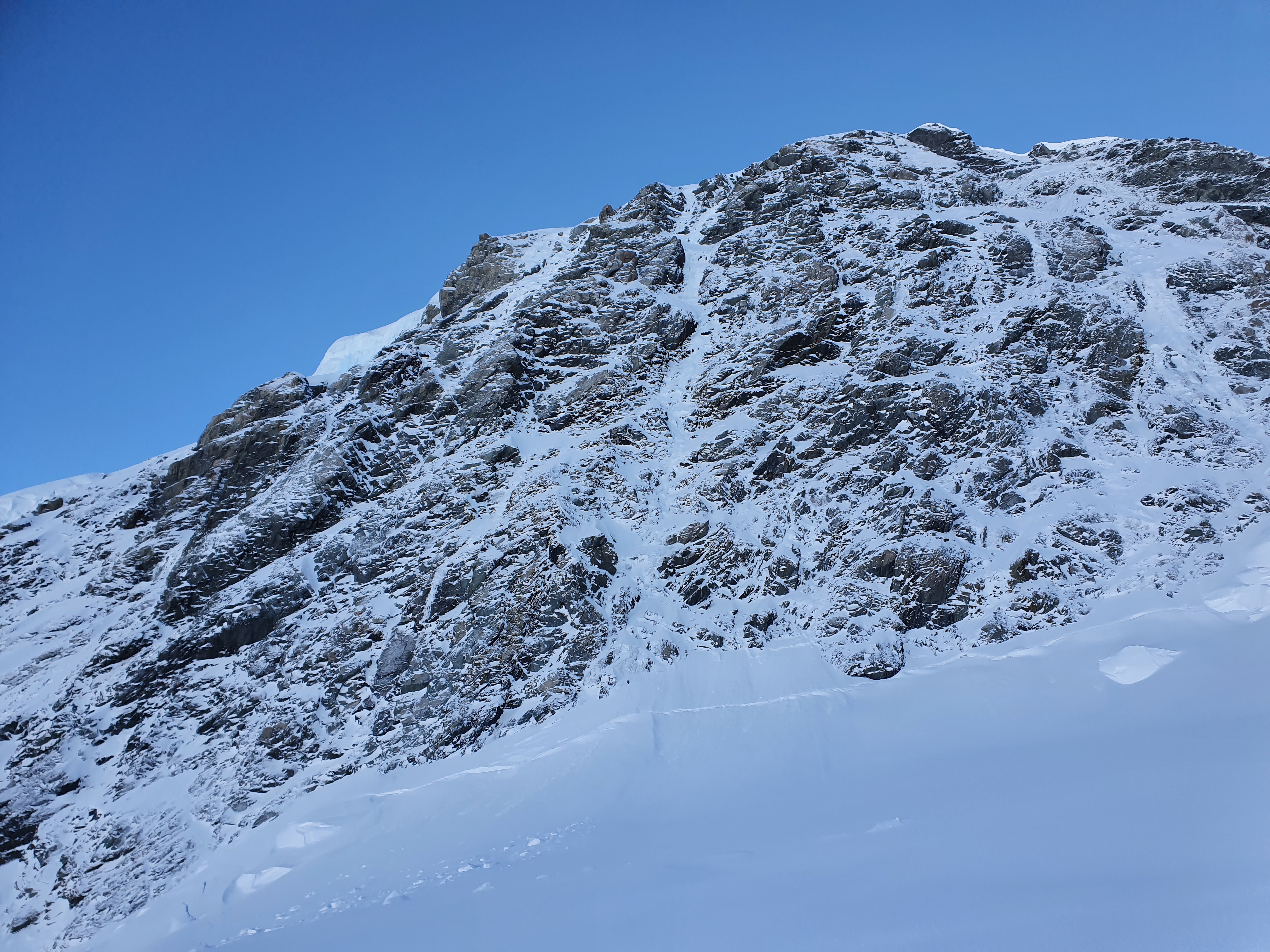
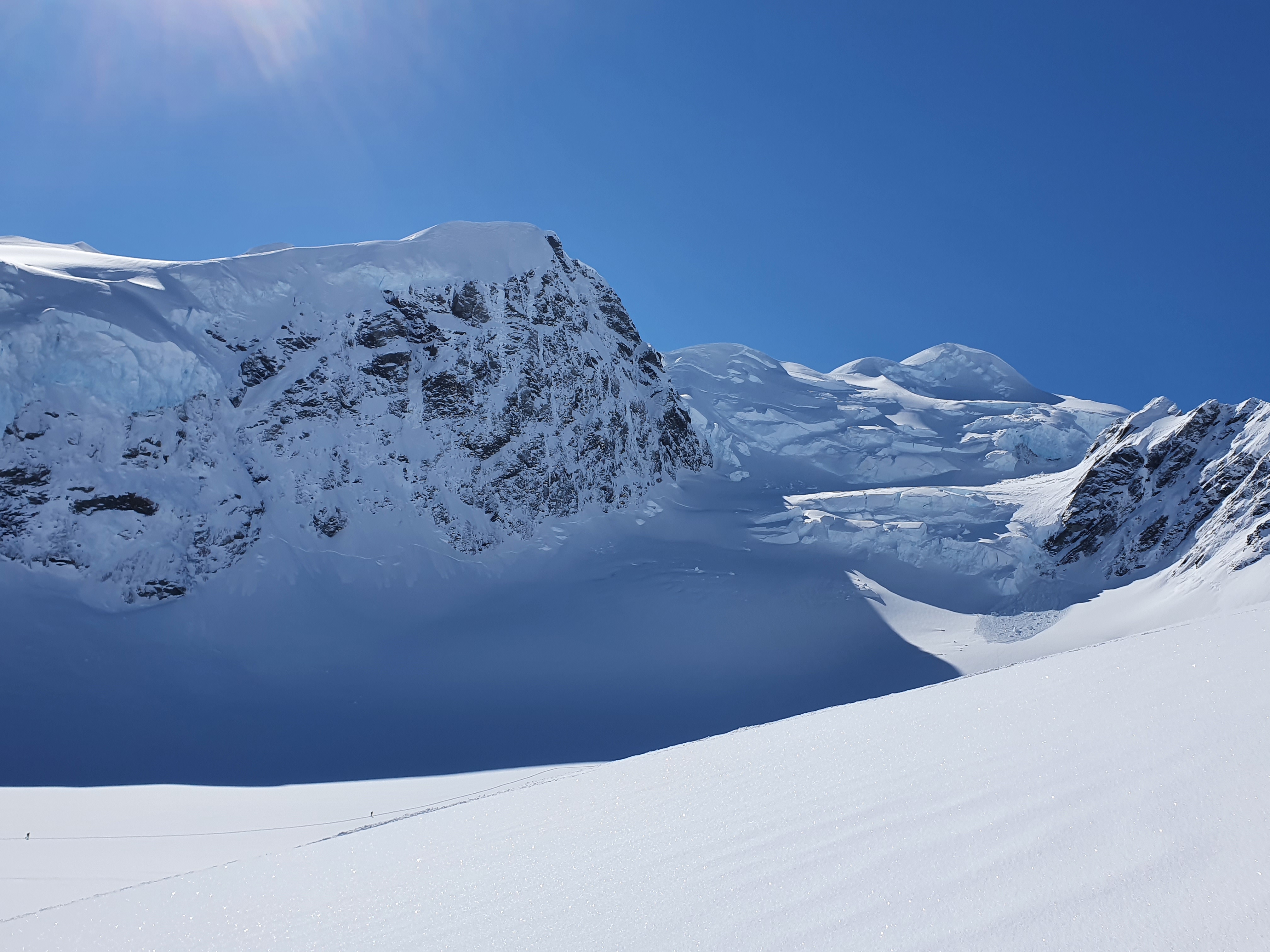
The route has a large snowfield threatening it and gets the morning sun – if its been loaded and/or a big increase in temps then theres a real risk of avalanche coming down the route, or you triggering something while going up the summit snowfields. Curtains and Original route are a little more protected from this perspective.

Climb
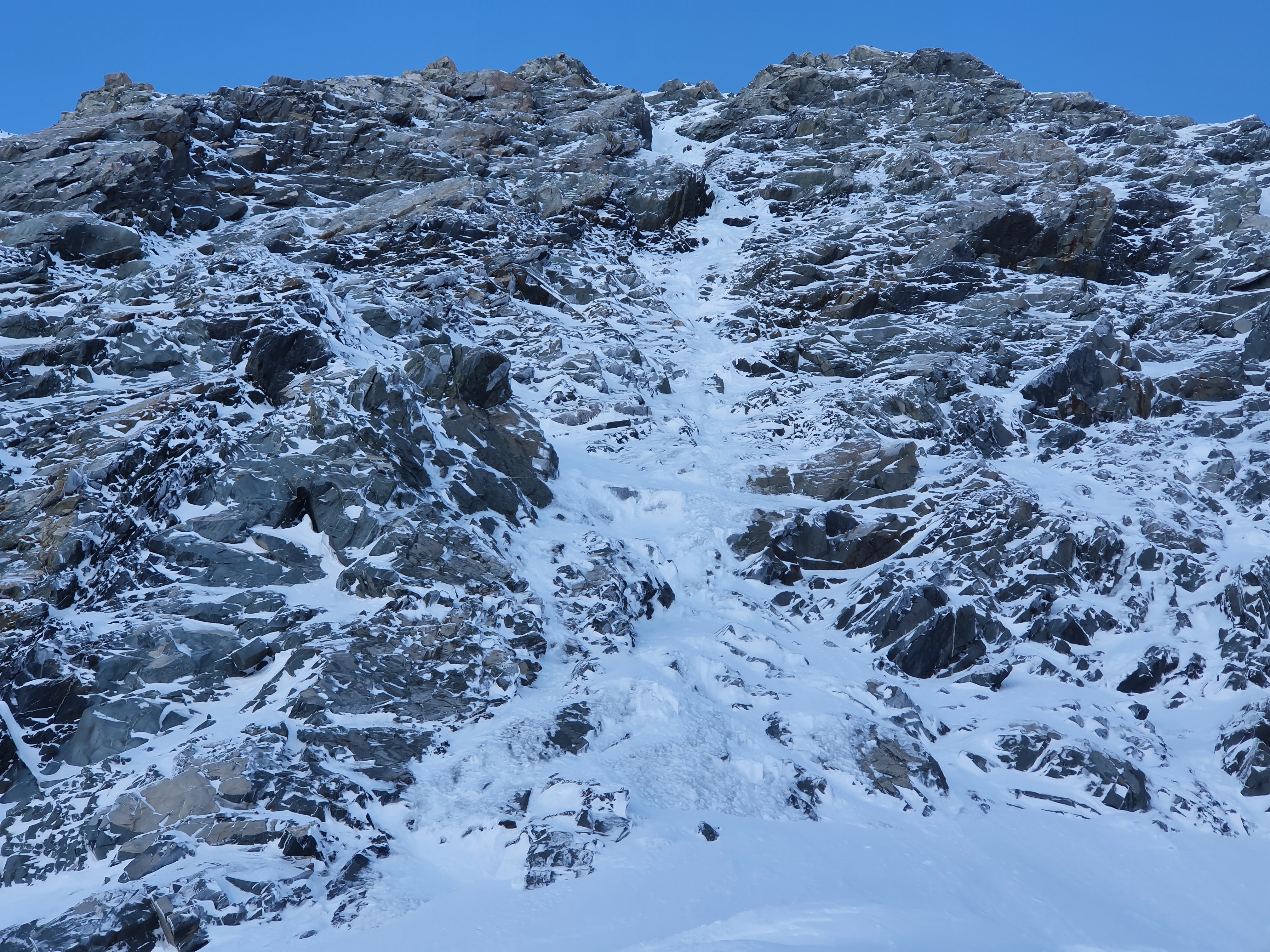
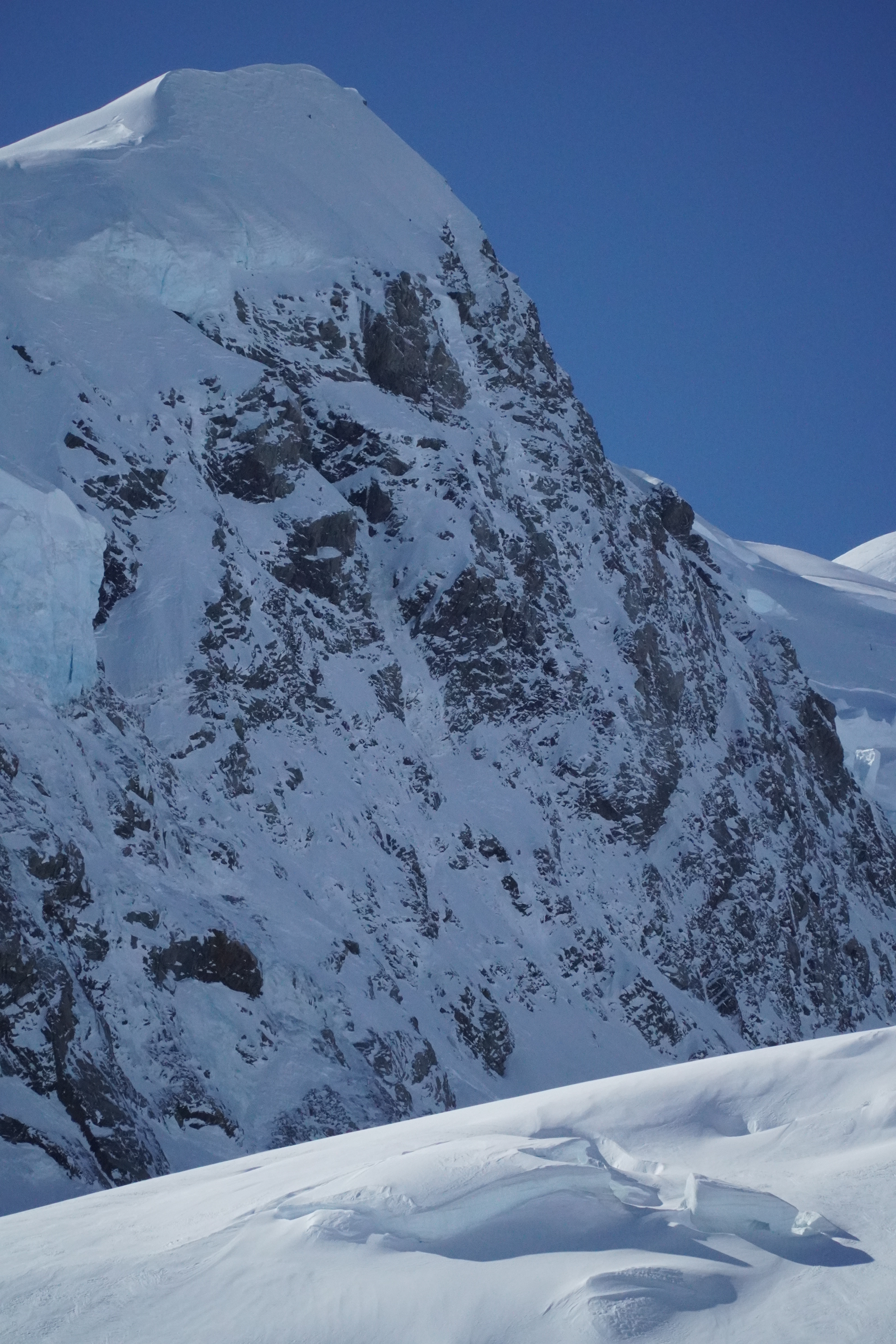
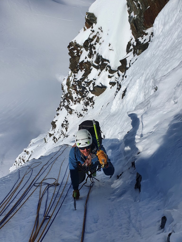
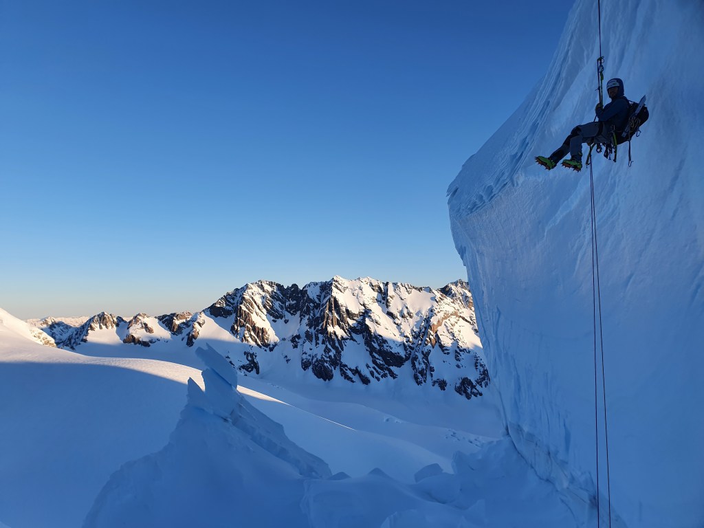
We made 7 pitches to get to the summit snow field and then simulclimbed to the summit ridge. It took a bit of poking around to find a spot to cross the shrund and get established on the route. From afar we were a little worried that the first pitch looked a bit scratchy and thin, but once we got to the face there was pretty perfect polystyrene ice the whole way up. Right from the first pitch the protection was good, sinking 16cm screws and taking 19cms for the anchors. The route essentially goes straight up, with a rightward trending ramp about halfway up. This first half is sustained WI3. Past the ramp there are 2 small low angle snowfields linking the last 2 pitches. The climbing is the hardest on these last pitches at WI4. We had a 4-5m section of vertical ice just before the 1st snowfield, and then another similar section on the last pitch with some awkward traversing and a couple of mixed moves to get established on the final ice gully to the summit snowfield.

We made ice anchors the whole way up except for the last but one in the final snow field where we made a rock anchor. There was good ice but having brought a rock rack all the way up there felt like we should probably use it!
The is a fair bit of East in the aspect and we were climbing in the sun from pretty much first light until around 11am. Excellent for shaking off the early morning barfies!
As we were getting to pitch 4 a heli came and hovered about 100m from us obviously scoping us out. In our sleep deprived and mission focused mind set we assumed it was the guys from the hut who we had been chatting to the night before – we knew they were flying out around then and they were stoked on the fact we were climbing the route so assumed they were just stopping by on the way out to take some photos. We gave them some enthusiastic shakas and carried on climbing. After a few minutes they flew off. Only when we got to the summit and got phone signal and a thousand panicked whatsapps did we realise Sean had butt dialed his Spot PLB, sending a distress message to his wife who had promptly triggered a SAR rescue. Seeing us climbing on and giving our most enthusiastic chakas they figured out what had happened and left us too it – cue grovelling apology and box of beers brought to the SAR boys on our return. Sorry about that!
It turns out that this is a really common occurrence with SPOT PLBs and SAR have had multiple false call outs this season alone. In addition, when they were analysing our distress signal the GPS co-ordinates were totally wrong and were telling them we were on the West coast somewhere. Time to upgrade to an inReach Sean!
We hit the summit at 15:00, spent half an hour calling significant others to explain what had happened (and apologising) we started to make our way back down.
Descent

From the top of the route head north east to the summit of Walter on easy low angle slopes. From the summit traverse an exposed ridgeline around 100m long. This can be heavily corniced on the east side and is steep and exposed to the west. It was covered in rope snagging sastrugi when we were there so we soloed this section. From here its a single 60m rap down to the Walter Ellie col. We left a picket behind to rap off. From here walk down the Anna glacier to the start of the route. Its well worth getting a look at this/taking some pictures from the bottom as there are several big seracs and the route finding is not obvious from above. When walking down from the col youu need to go further left than you think – we went too far right and ended up having to make another rap off a v thread over a serac band. Once you leave the col your threatened by seracs from above, so move quickly. They tend to be more active further east.
An alternative (especially if you brought your skis up with you or the Anna is cut off) is to ski south from the summit of Walter past Divers col and down to the 2000m contour on the Tasman. This would be a big old day on foot.
After munching the rest of the food we had stashed we chased the last bit of evening light back up the Tasman and ended up back at Kelman around 21:00, 18 hours after setting out.
When we got back to the hut everybody was talking about our SPOT cock up – as part of the rescue attempt every guided group in the park had been alerted to what was going on. And to make matters worse when leaving the hut I had managed to put on the wrong pair of ski boots – there were about 25 pairs of boots and I had picked up an identical pair to mine in almost the exact same place, just 1/2 a size bigger. So they were extra comfy for me….but not so comfy for the guy that ended up with my boots. (I was wondering why they didnt quite fit into my bindings…but had just readjusted them for my other boots and assumed I just hadnt adjusted it quite right). He had spent the whole day touring in them and then flown out early afternoon so never got a chance to give me a bollocking in person. I can only imagine how pissed off he was……..but he didnt let it show when I called him once I was down to arrange the swap. Sorry buddy! So that was a second box of apology beers from one trip – a good lesson to me to write my name on my boots in huts from here on in.
So a successful trip in terms of climbing but otherwise managed to totally kook it! (although I can really recommend climbing in ski boots half a size too big….extremely comfy!)