
A New Zealand Southern alps classic route! Got a brief weather window in late Feb 2022 to sneak up this route. Popular with good reason – easy grade 10-12 scrambling on solid (by NZ standards) rock up to the west ridge, then a spectacular ridge traverse to the summit over the famous cheval.
Highly recommended. Would be especially good for a first foray into this kind of mountaineering – the Bonney rib is fully equipped with high vis rap stations with 2 rings every 30m, so a retreat is very easy, lowering the level of commitment.
- Difficulty: Grade 3 Rock crux 12
- Equipment: 3-season mountain boots. 1x set cams up to blue, small set nuts. 8-10x runners, plenty of 120cm slings. Microtraxion if simulclimbing. Tat for raps on the top section (before the bolts).
- Approach time: time was short so we opted to fly in and out to Darwin corner. A back flight between 3 people was only $150 each – maybe less than the damage to your equipment from walking over the Moraine?
- Climb time: we took 12 hours tent to tent, but pitched all of the route to the cheval. Much faster if simulclimbed.
- Season: late summer. You want all the snow to be off the route, and even at the end of a long dry summer in 2022 no issues crossing the glacier.
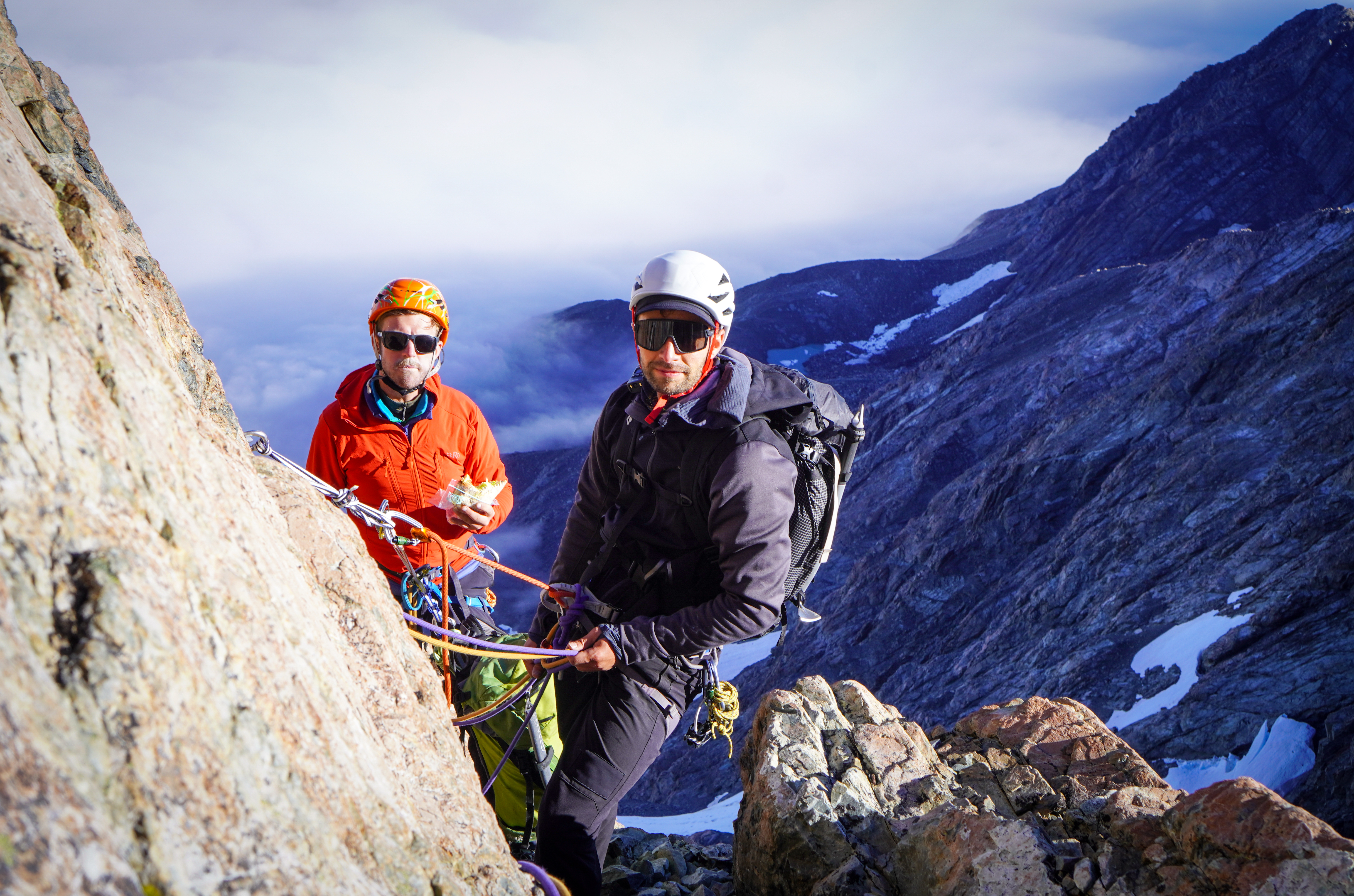
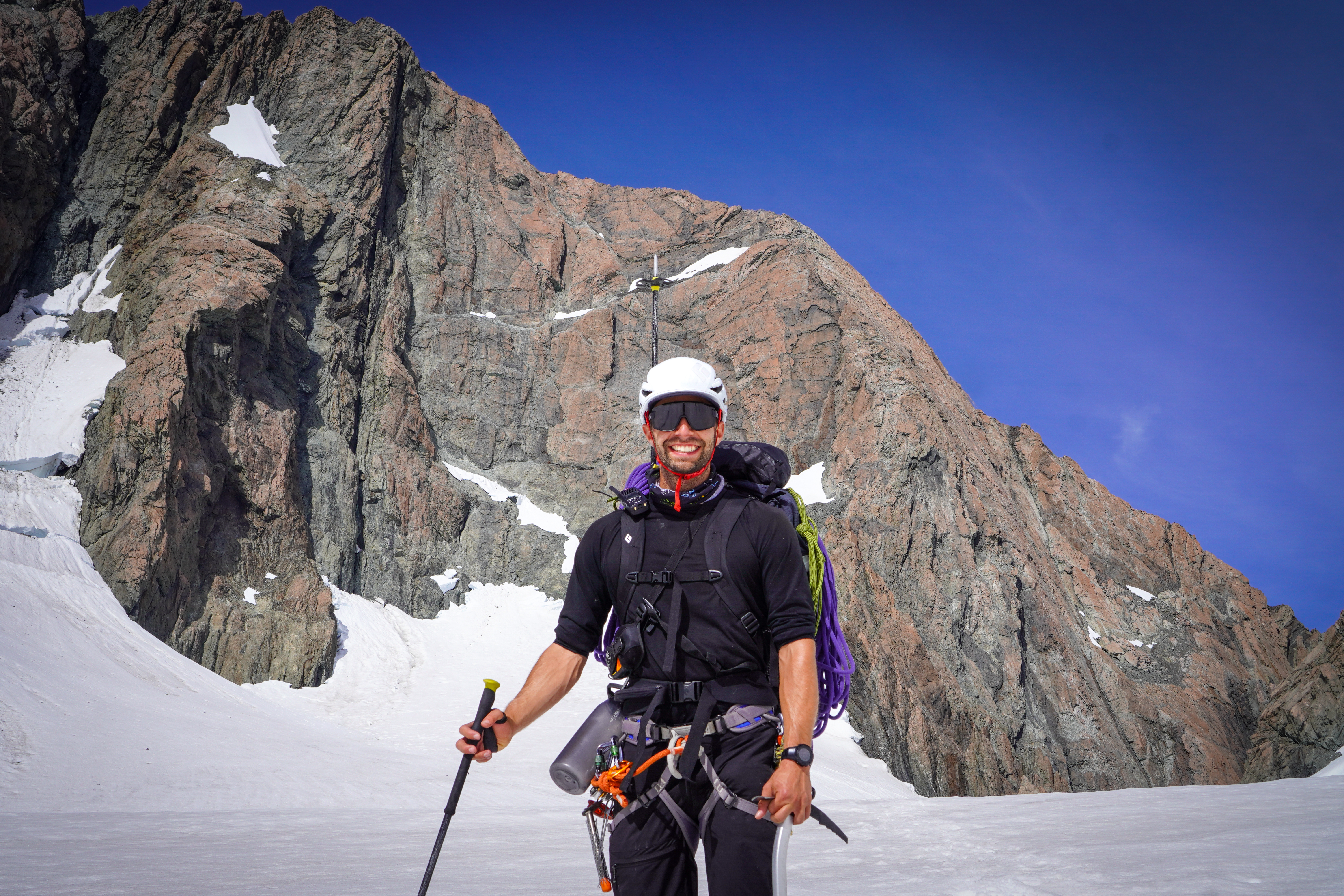
- Team: Joe Collinson, Alex Bewick, Tom Brown 28/2/2022
Access
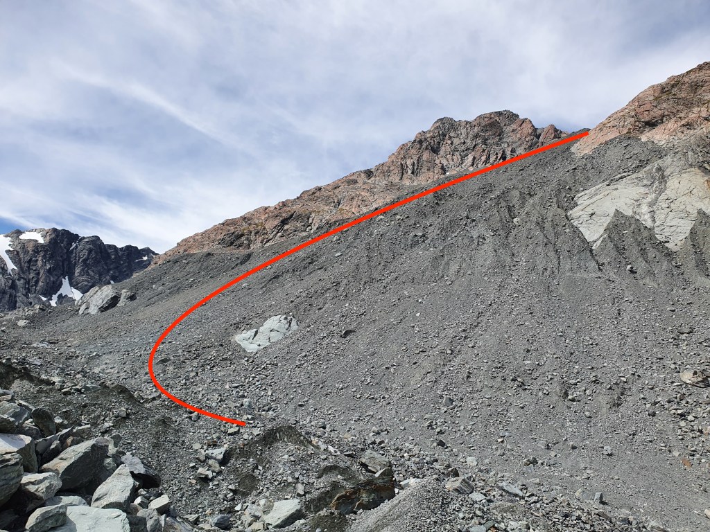
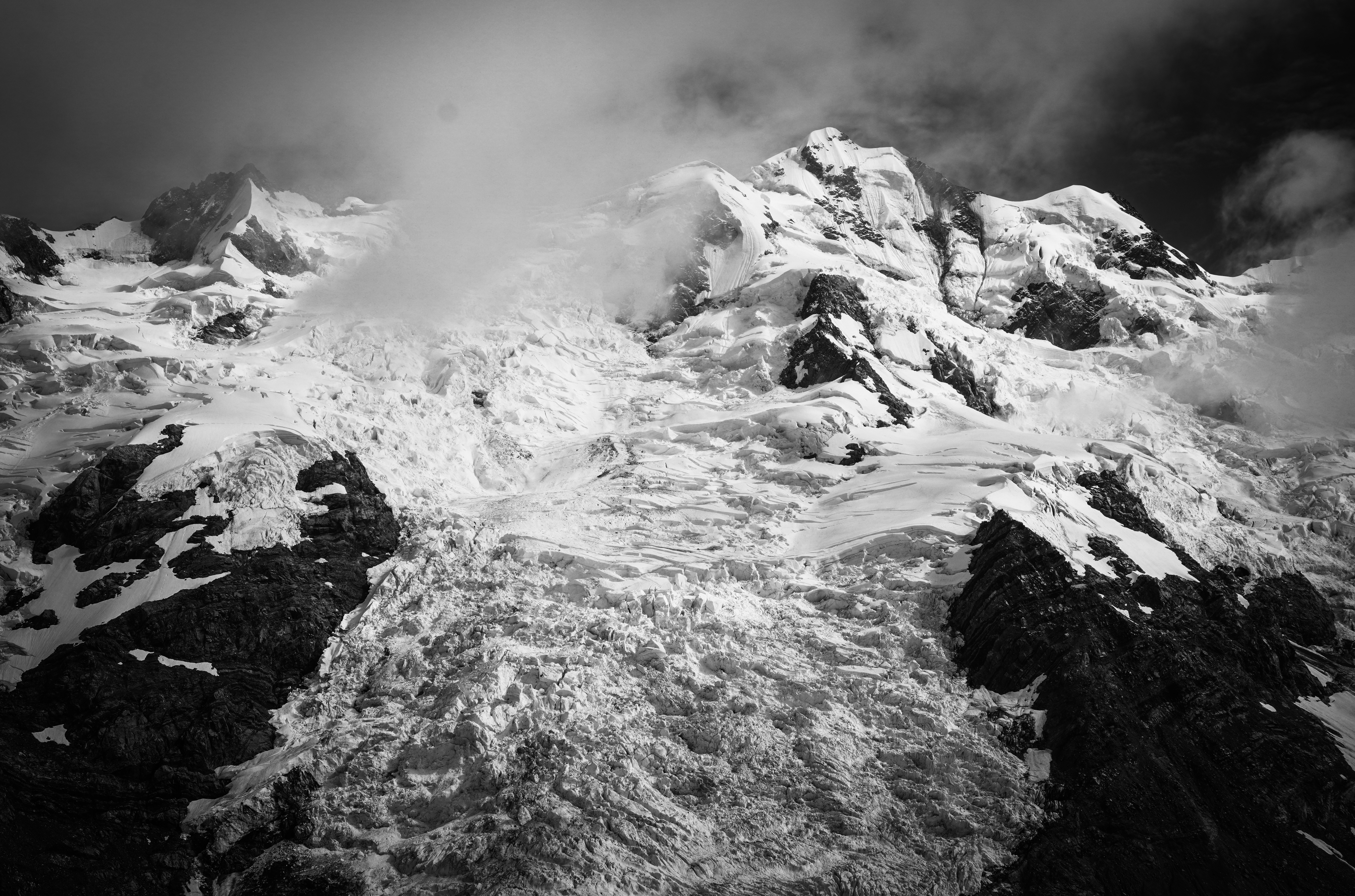
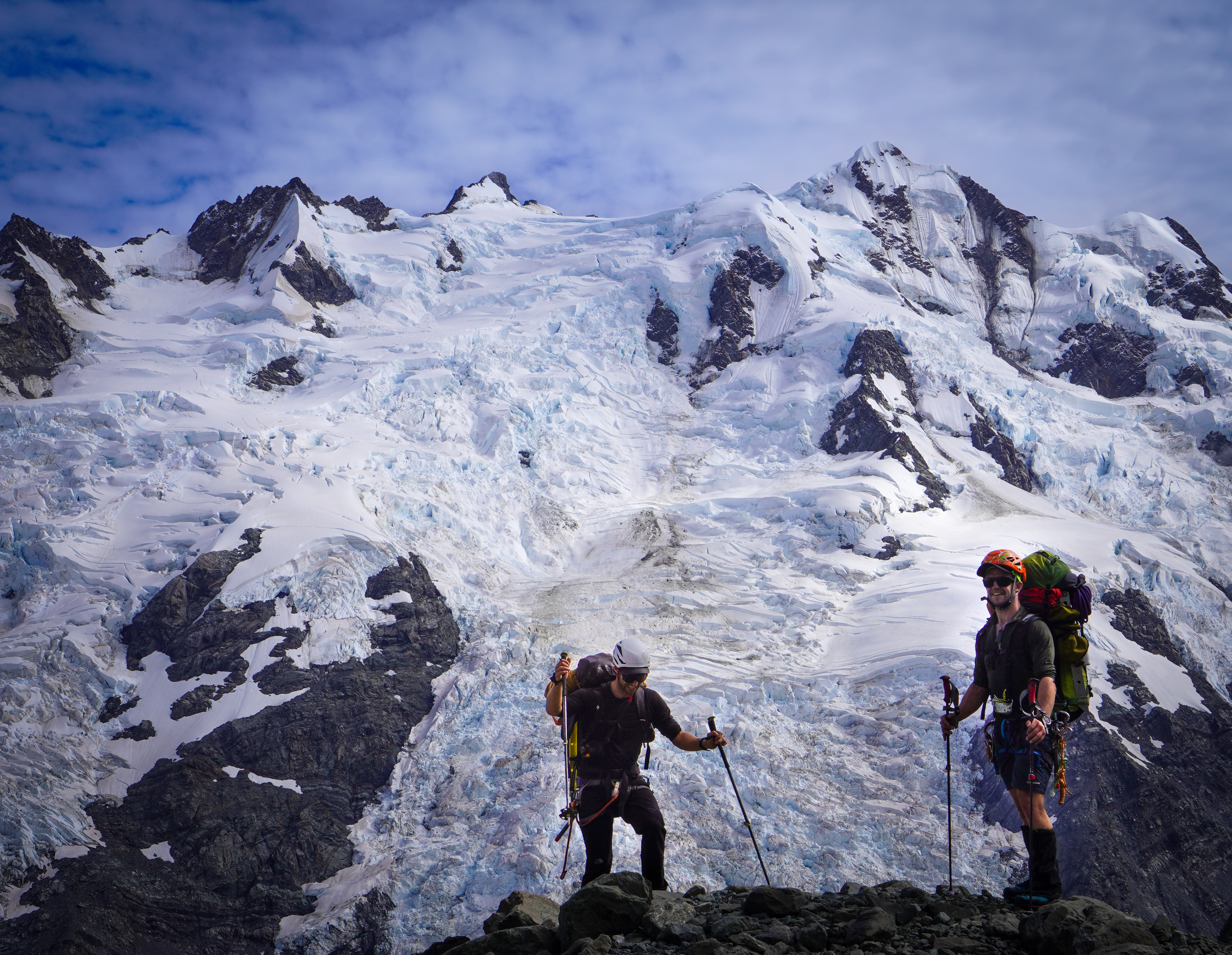
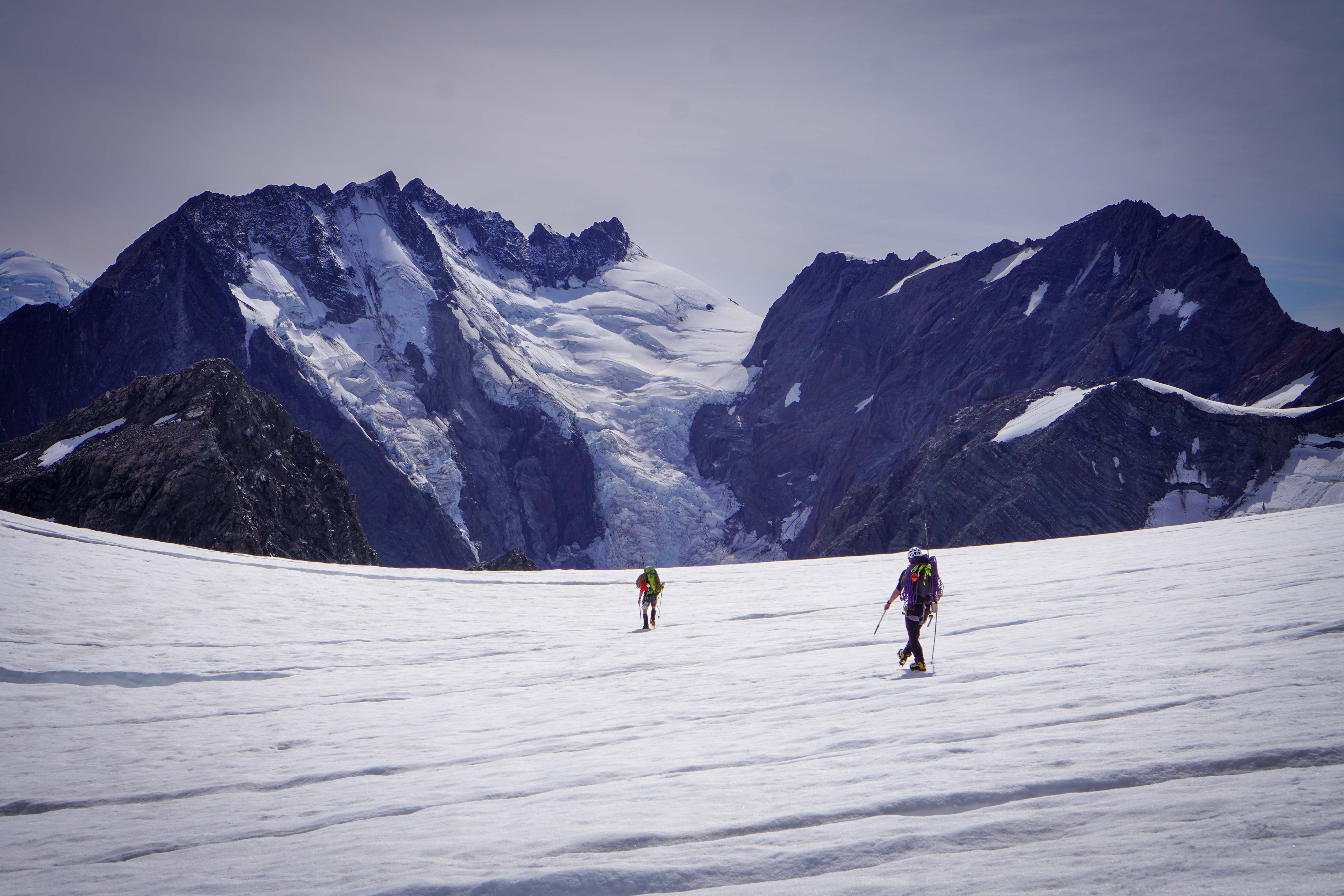
From Darwin corner, access the Turnbull glacier by first ascending the moraine wall. Probably the most dangerous part of the trip (especially the descent). Steep and loose with lots of large unstable blocks to knock down onto yourself or your partner. As of March 2022 the moraine wall is less steep the further lookers left you go, with the area to the right divided into a series of steep and scary looking gullies. We ascended almost directly under Mt Turnbull and then traversed to lookers right across the scree slope above.
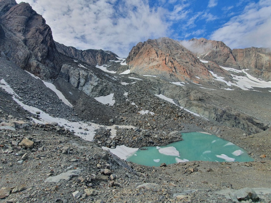
You pass a lake near point 1906 and then there is some boulder hopping onto the Turnbull. The Turnbull glacier has receded significantly and gave us no problems, although at around 35-40 deg, be careful of avalanche risk especially when getting warm. Where the Turnbull joins the Bonney there are a few crevasses to negotiate but even at the end of Feb 2022 which was especially hot and dry there was no issue crossing these to get to the campsite.
Don’t be tempted to go up the Malte Brun glacier – the moraine access at the bottom looks pretty terrible and the glacier is much more broken. Also the final bit up to the Bonney is a steep pile of horrible cross. Took us 4 hours from Darwin corner to campsite.
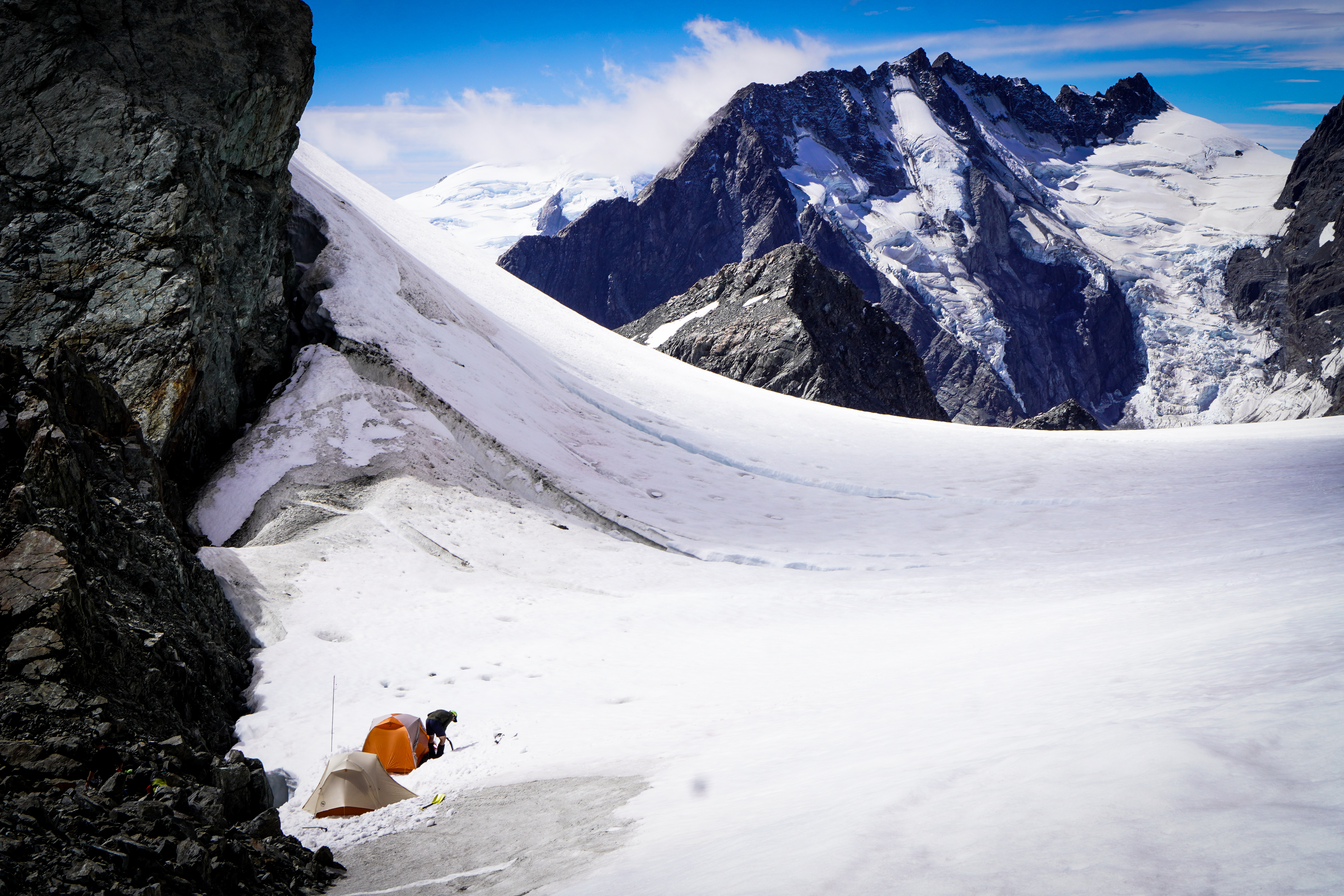
Camp
On the rock rib at the top of the Malte Brun glacier there is a good bivvy spot. Two flat areas in the rock have been cleared out which are about the size of a 2 man tent each.
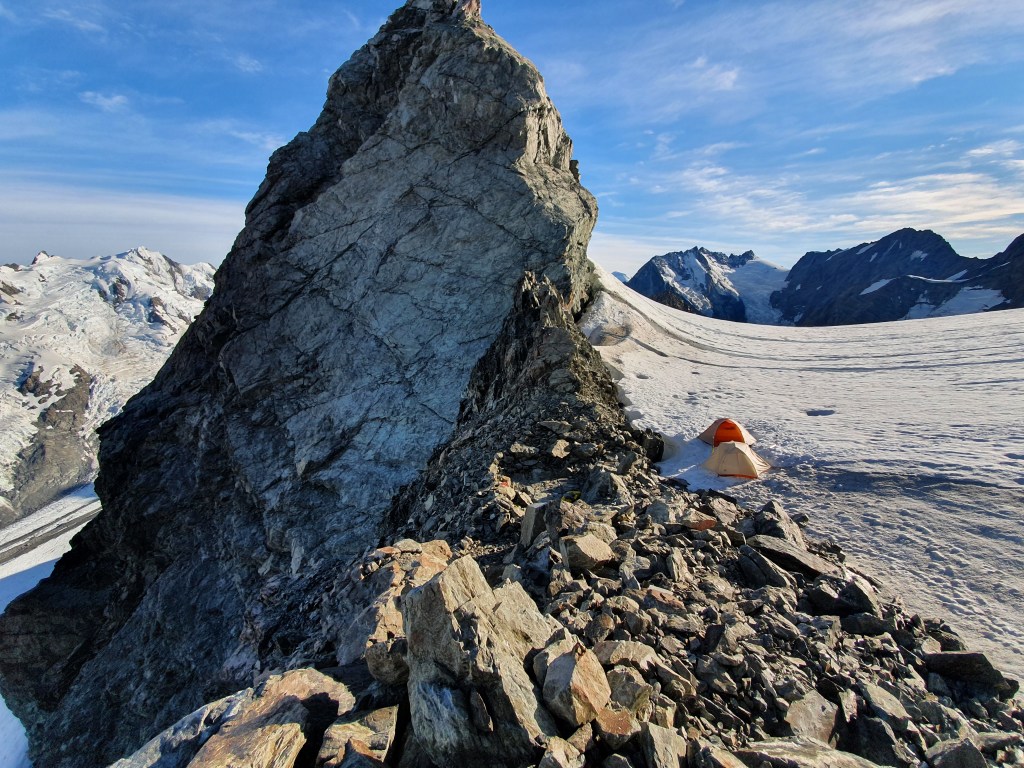
We opted to sleep on the snow just next to the ridge as we thought our inflatable airbeds wouldn’t stand up to the sharp rock. There was no water near the campsite so don’t forget the jetboil (like I did… The risk of packing straight after a night shift!). We were able to find running water across the schrund at the point marked in the photo, which saved the trip but it was a real faff and took forever. Another option would be to camp down by the lake if you don’t want to melt all your water – allow an extra 1-2 hours to get up to the start of the route.
The Route
We took the classic Bonney rib but many variations are possible!
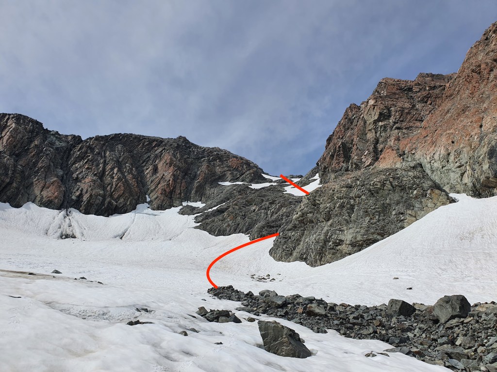
From the campsite, follow the snowfield up staying just to the left of the large gendarmes. Cross a schrund and climb a 40 deg snow slope up to a small gully with a boulder wedged in the top of it. The climbing starts from here.
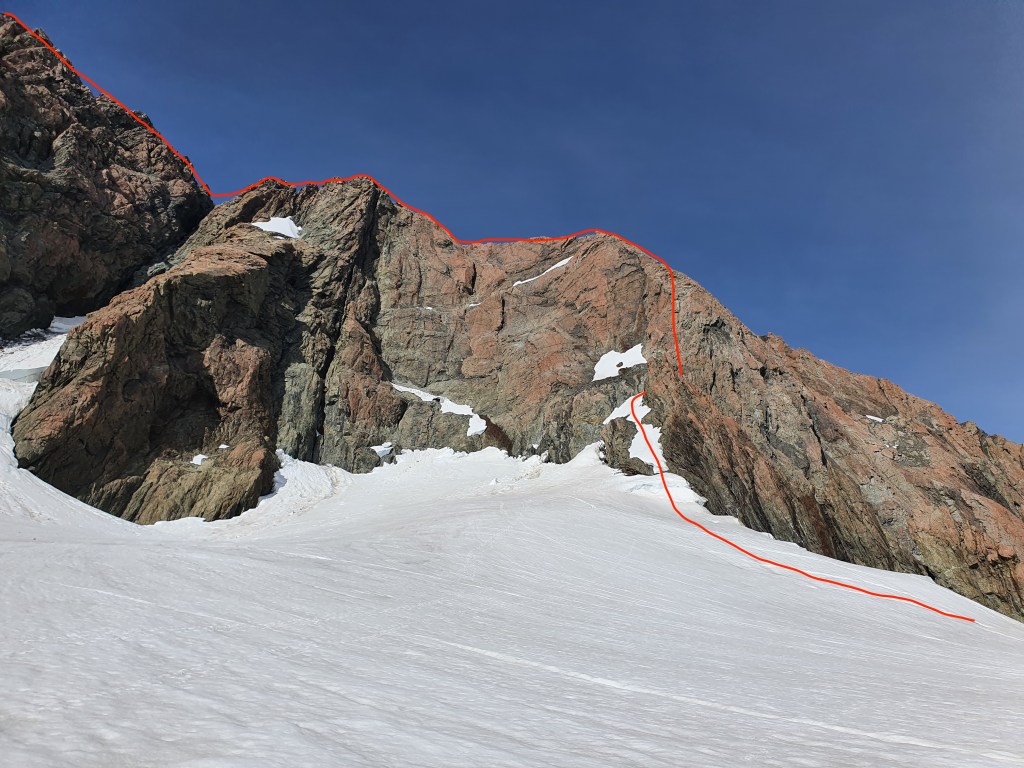
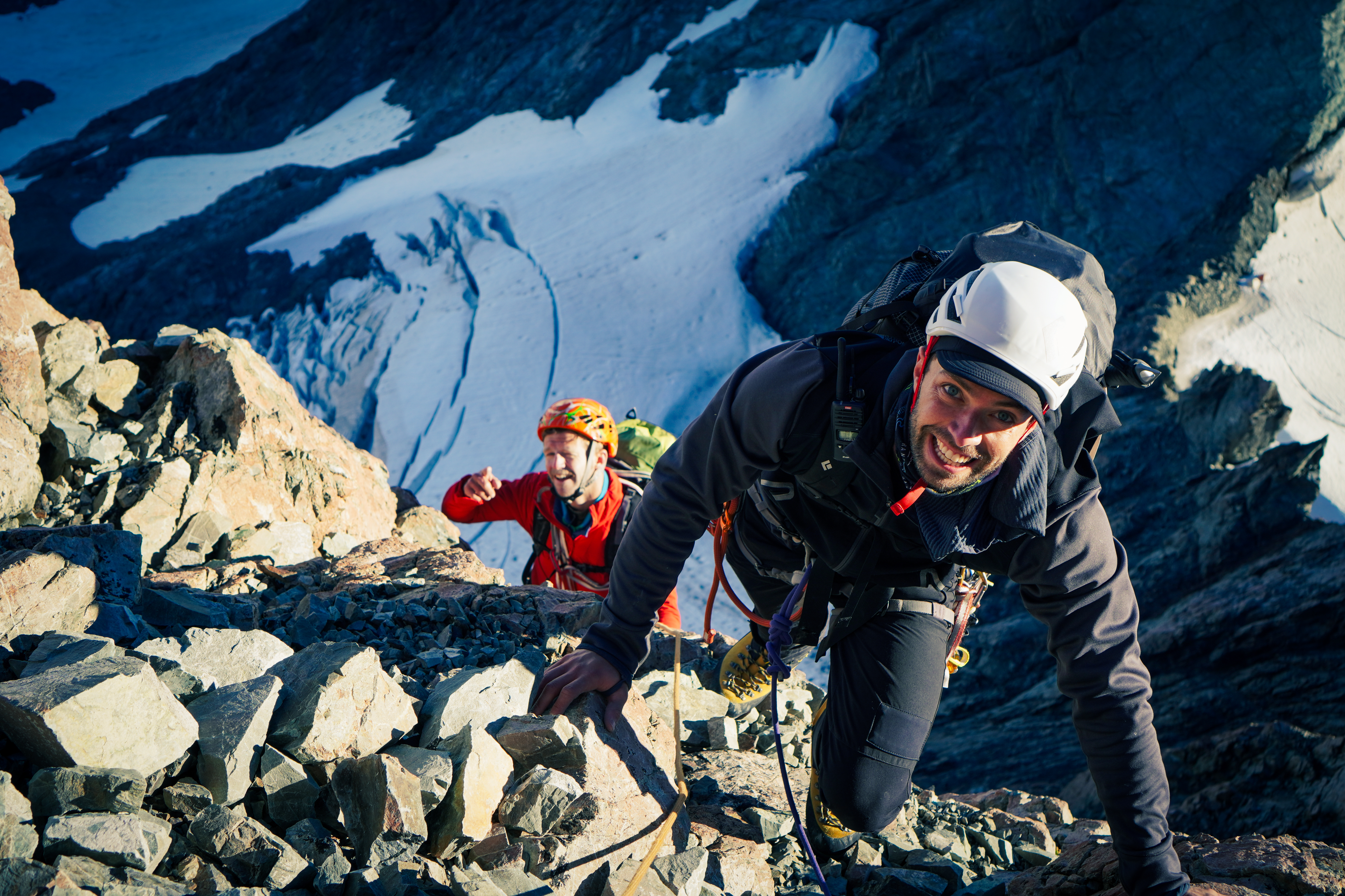
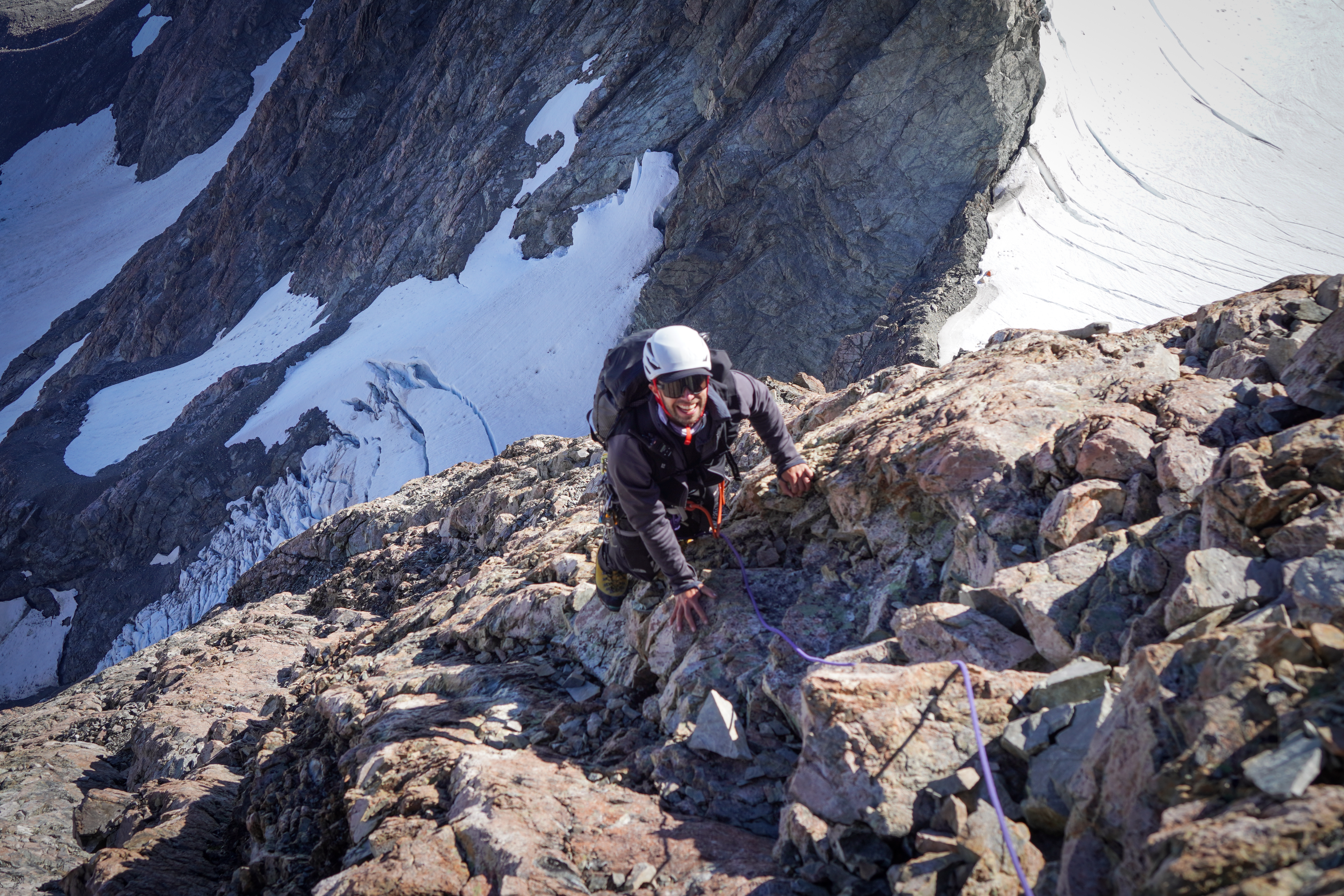
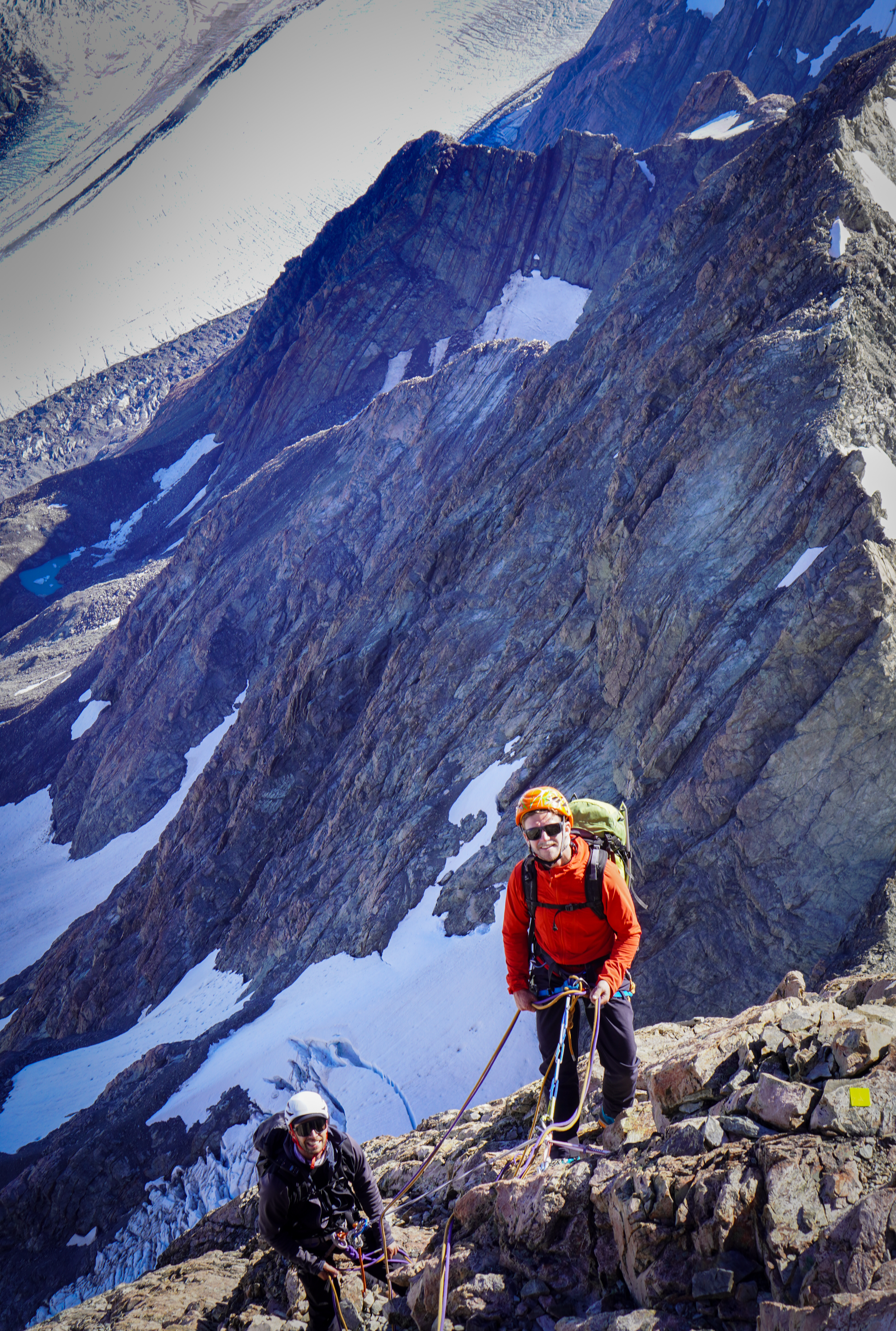
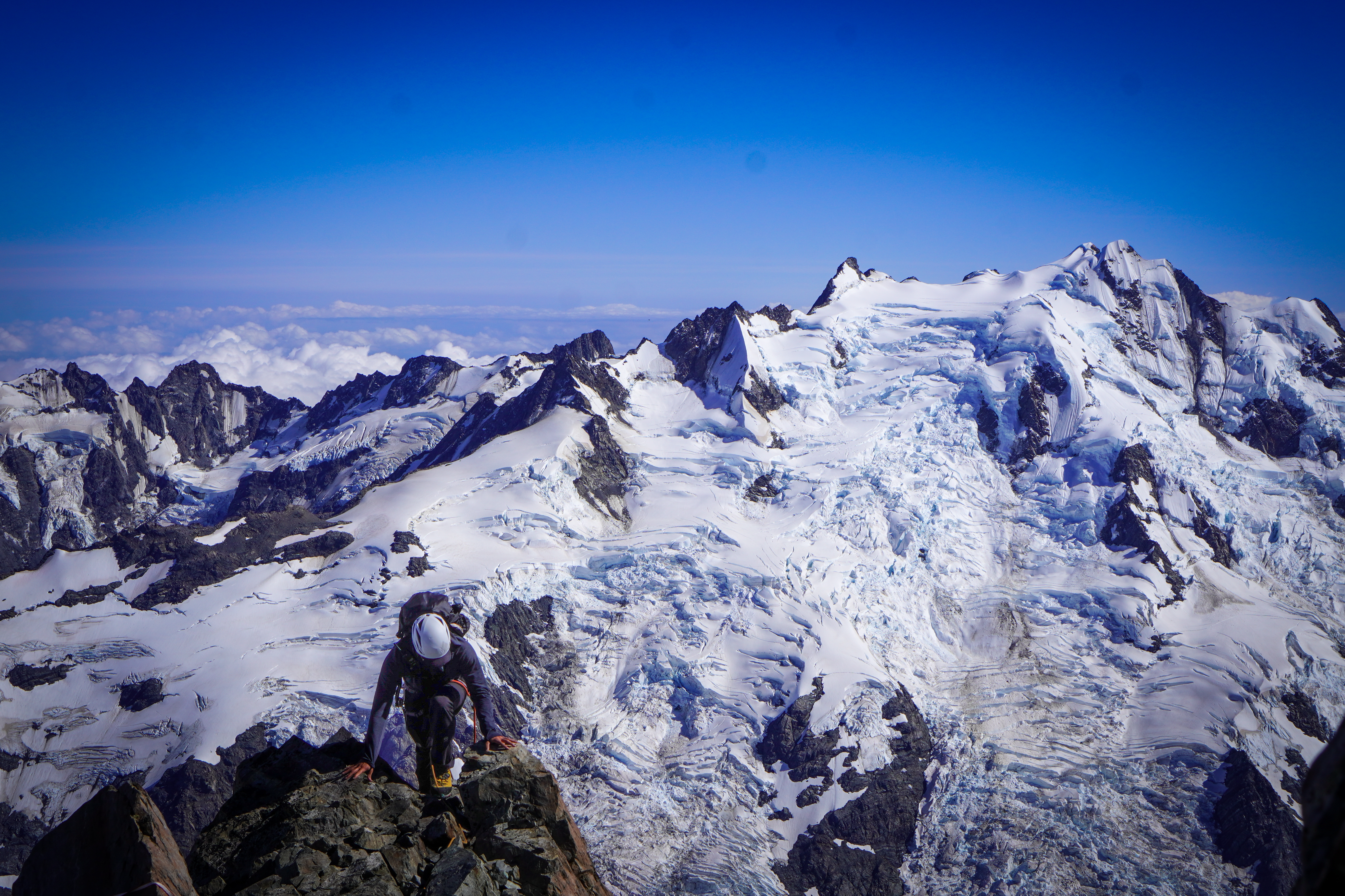
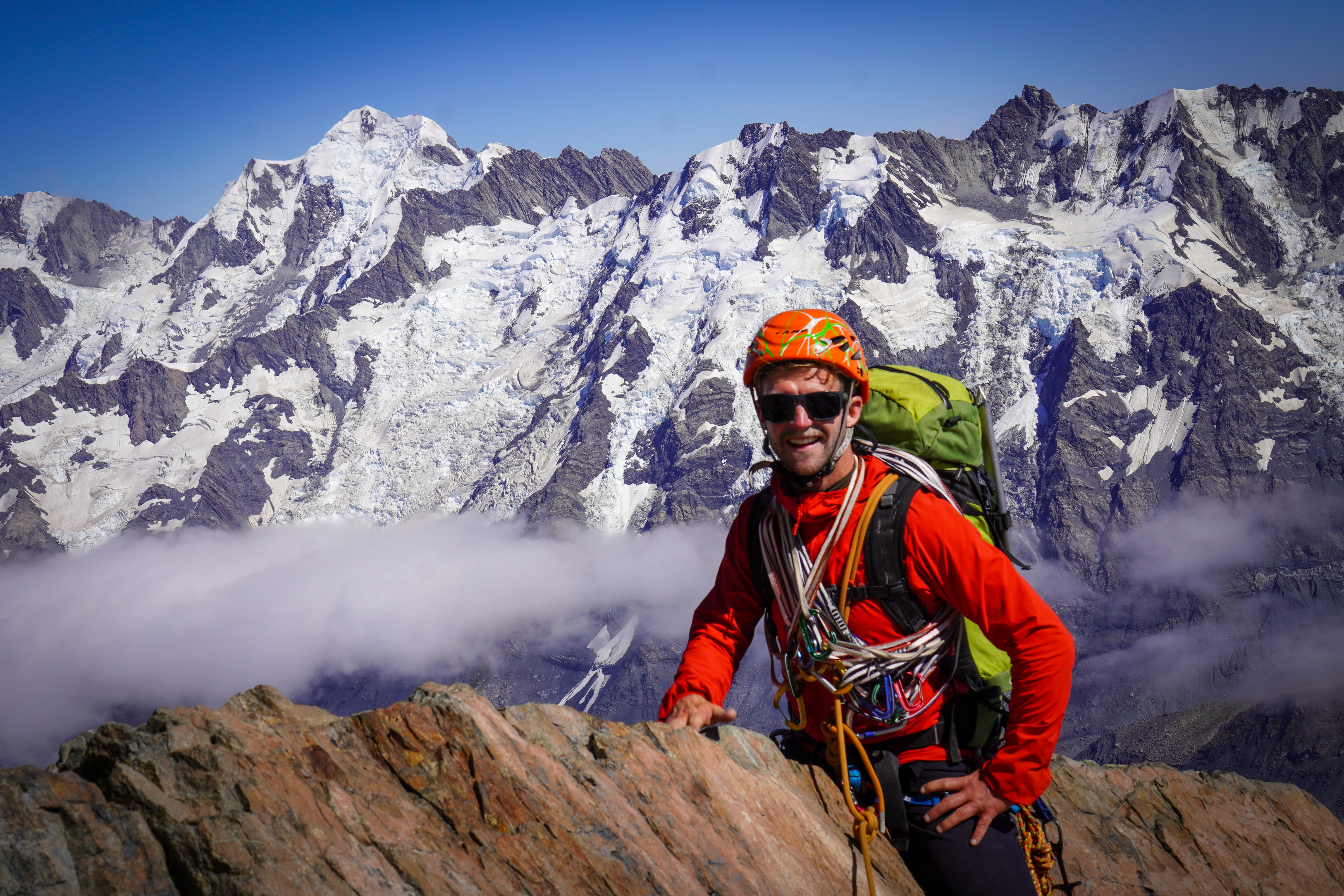
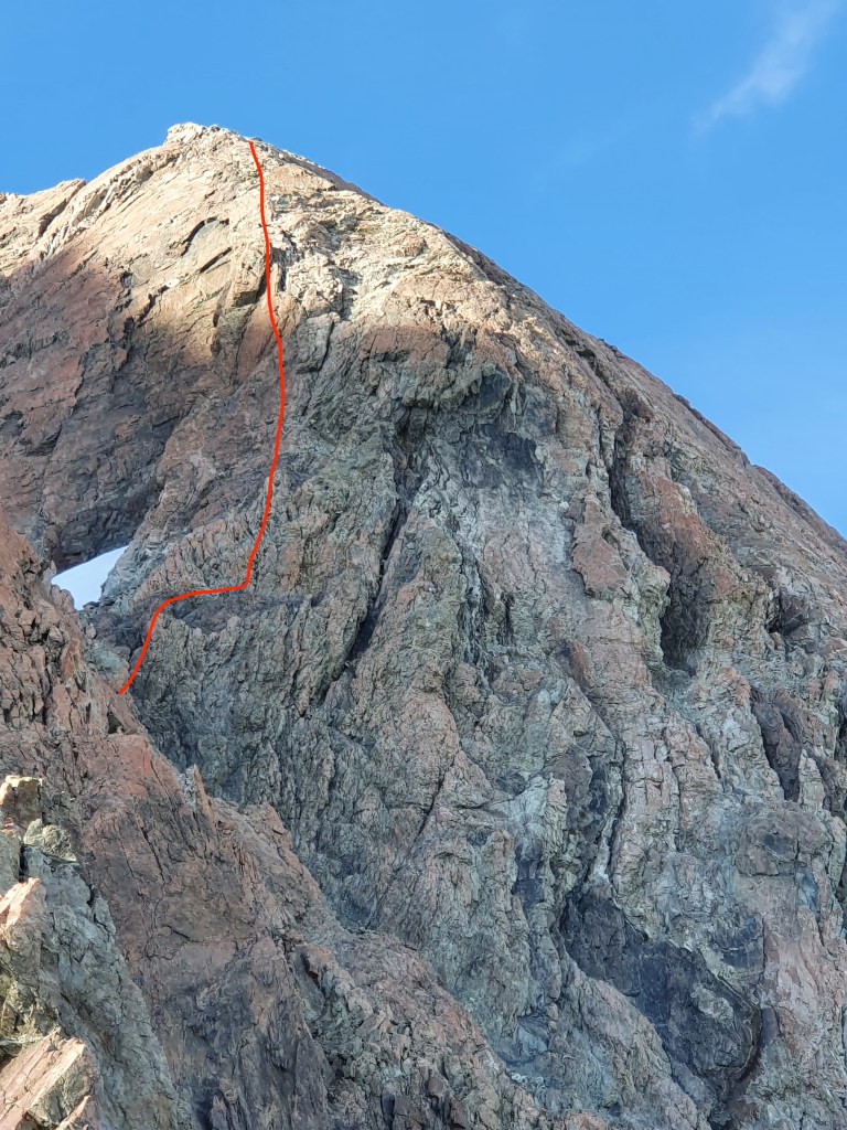
The first DBA is 60m above the boulder and then every 30m to the ridge. The first 2 are in a fairly straight line, but then after that they step out to climber’s right significantly and then meander round a fair bit. The most simple and least committing option would be to follow the DBAs all the way up, but the climbing is more interesting and on more solid rock if you follow a more direct line up the face. The DBAs can also be pretty difficult to spot from below, but there are high vis reflector strips drilled into the rock above each station so finding them on the descent even in the dark / bad weather is super easy. 5x 60m pitches to the ridge. Climbing is around grade 12-14 but obviously varies depending on which exact route you take. We pitched the whole thing as some members of the group hadn’t spent much time on rock, but could save some time simulclimbing in a confident party
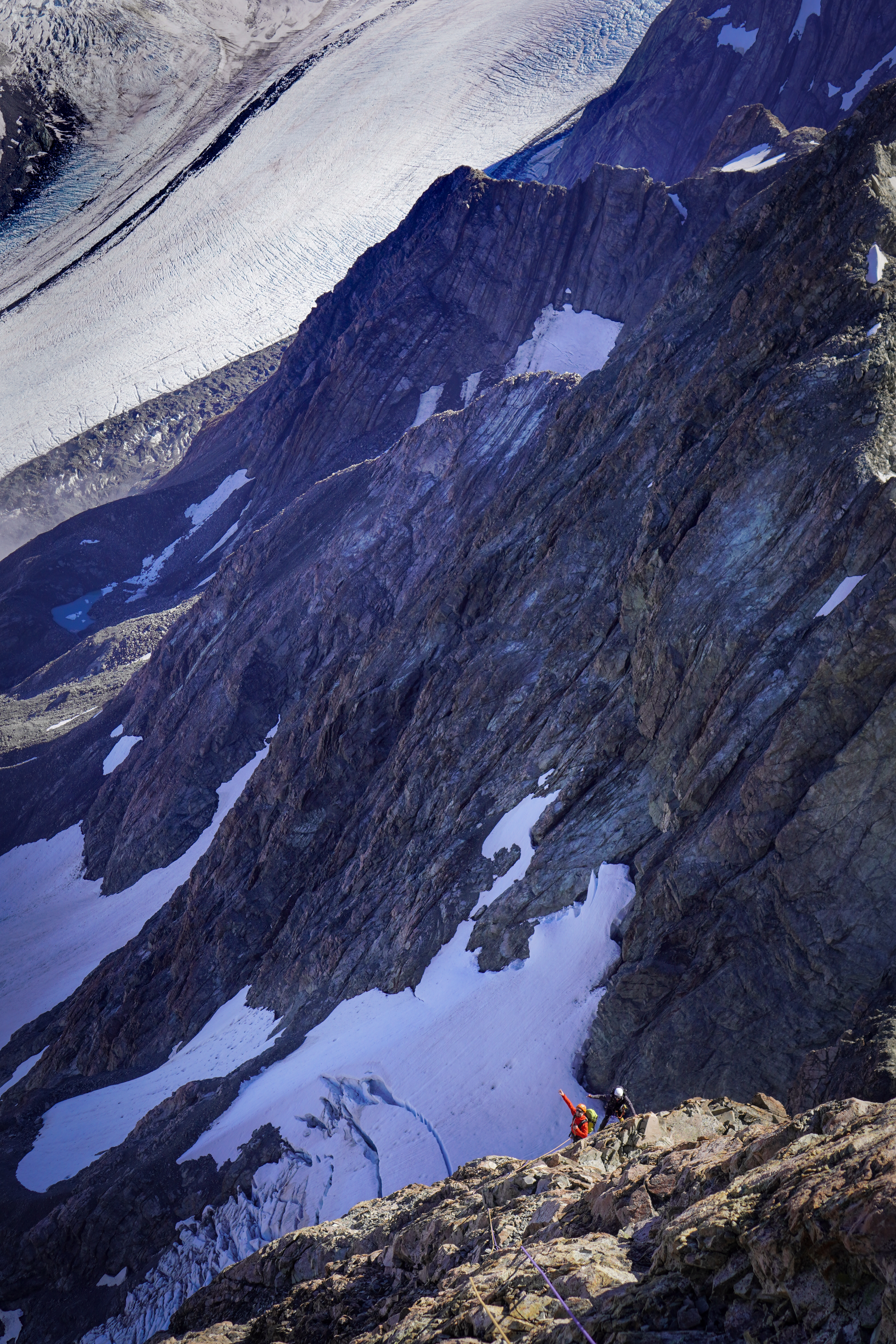
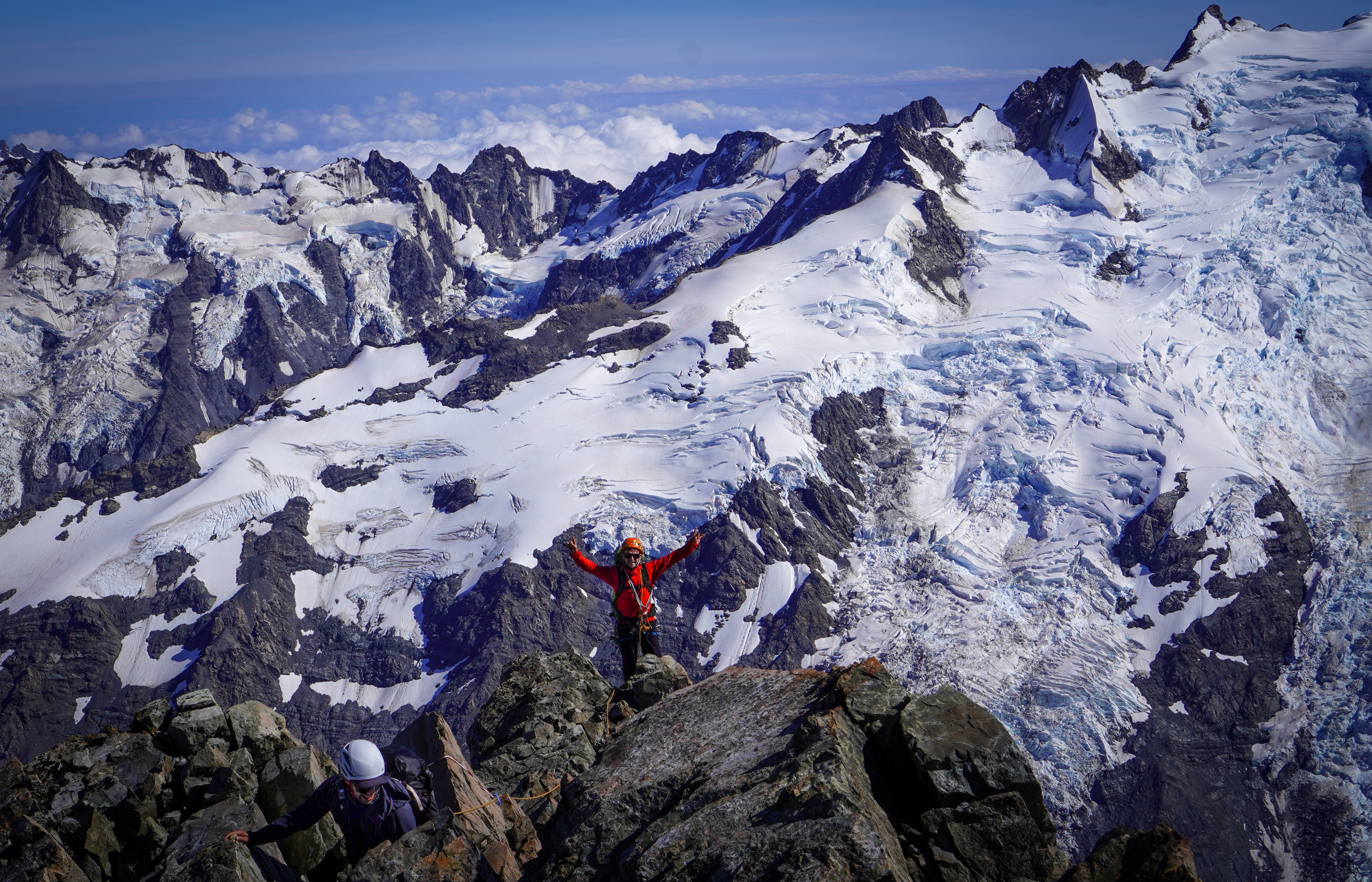
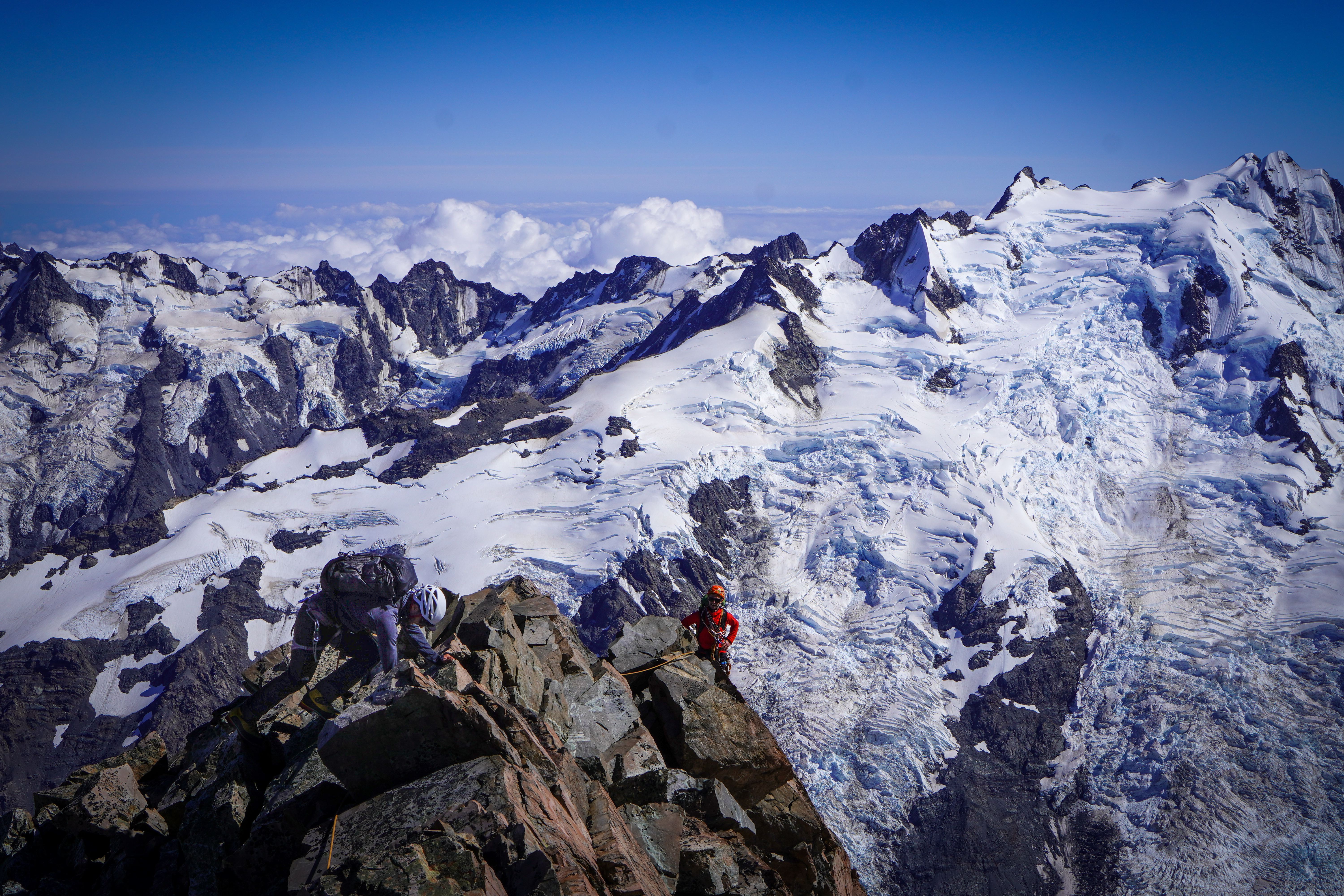
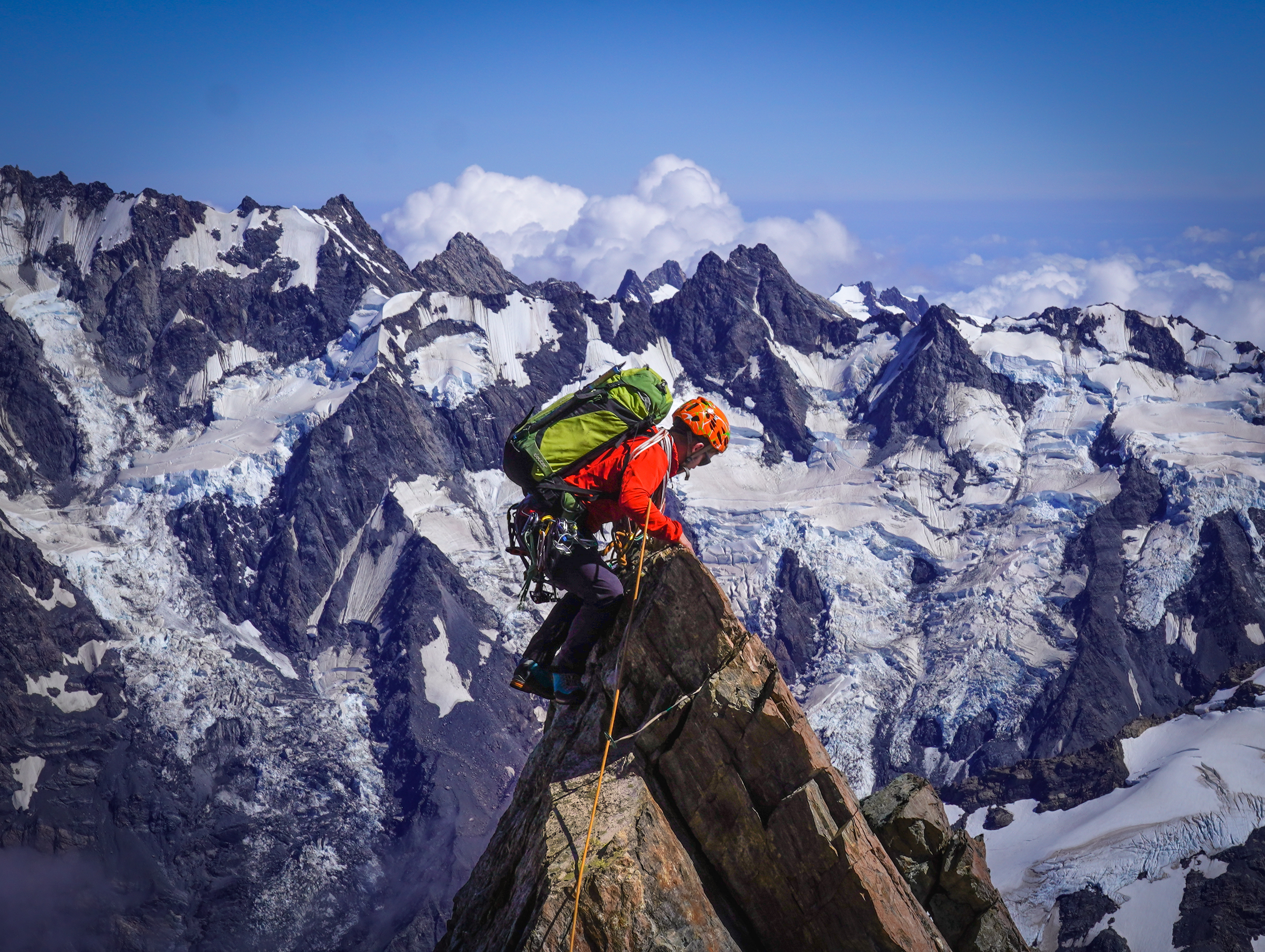
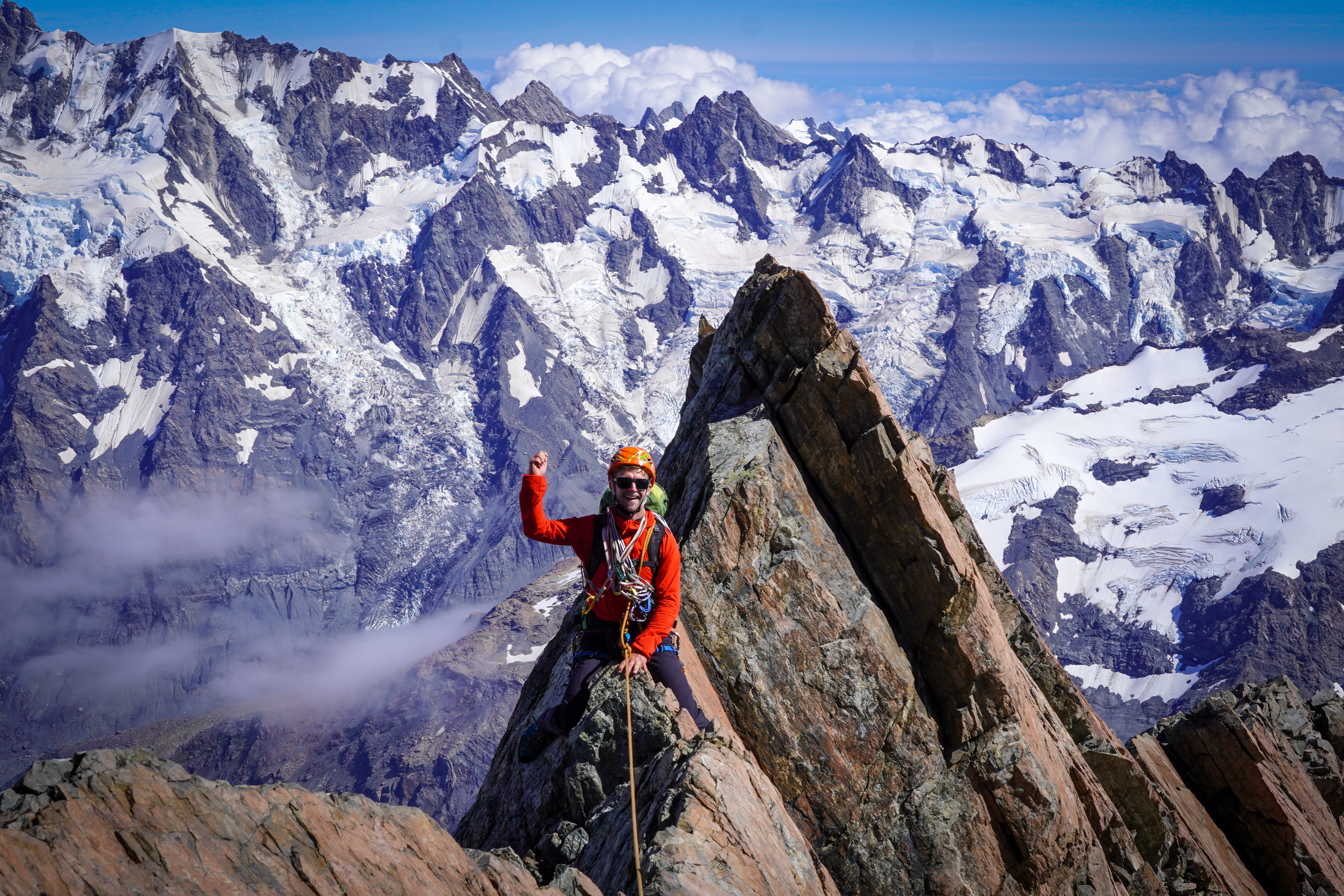
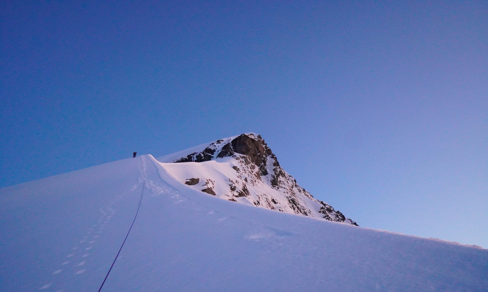
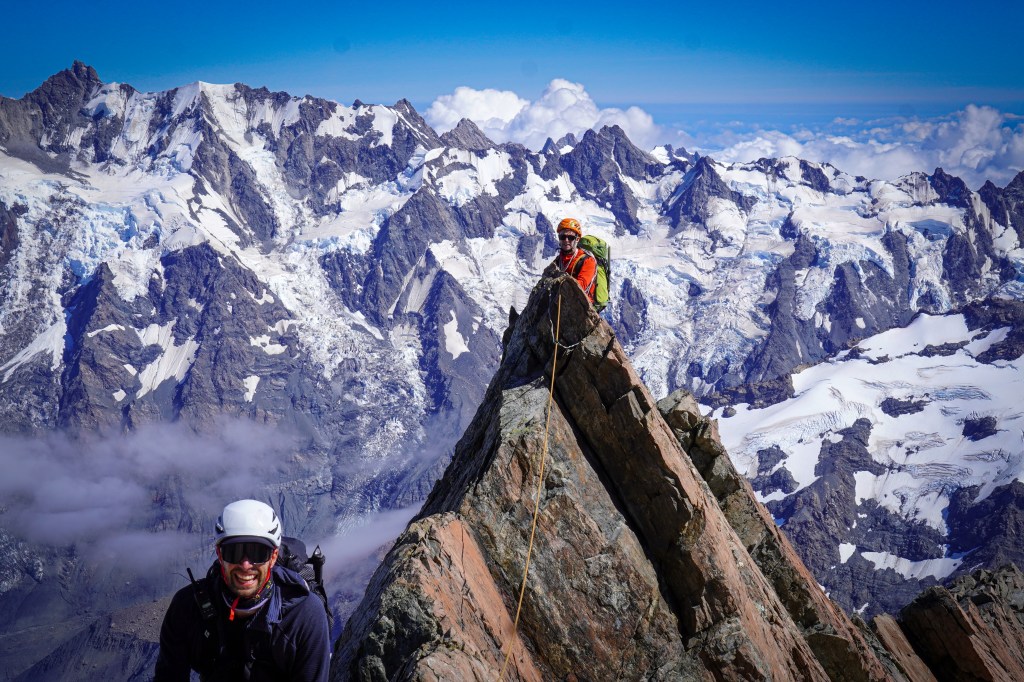
Once you gain the ridge, it took us about an hour to traverse to the end of the cheval. Exposed ridge travel , but with plenty of options for pro (especially loads of spikes – bring plenty of 120cm slings) for simulclimbing. Send the camera out front for the obligatory cheval shot! Theres an old rusty piton next to a good platform at the end of the cheval.
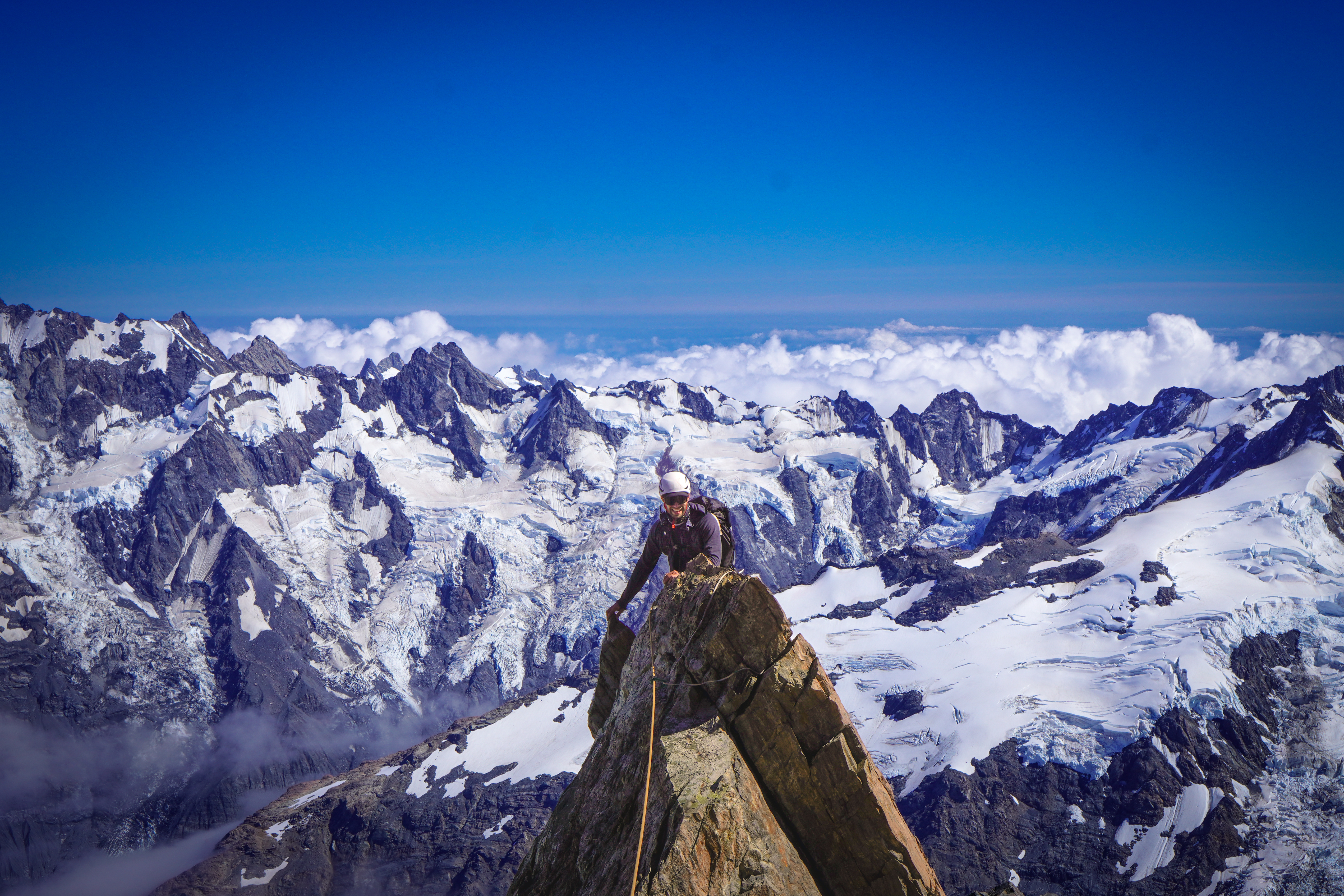
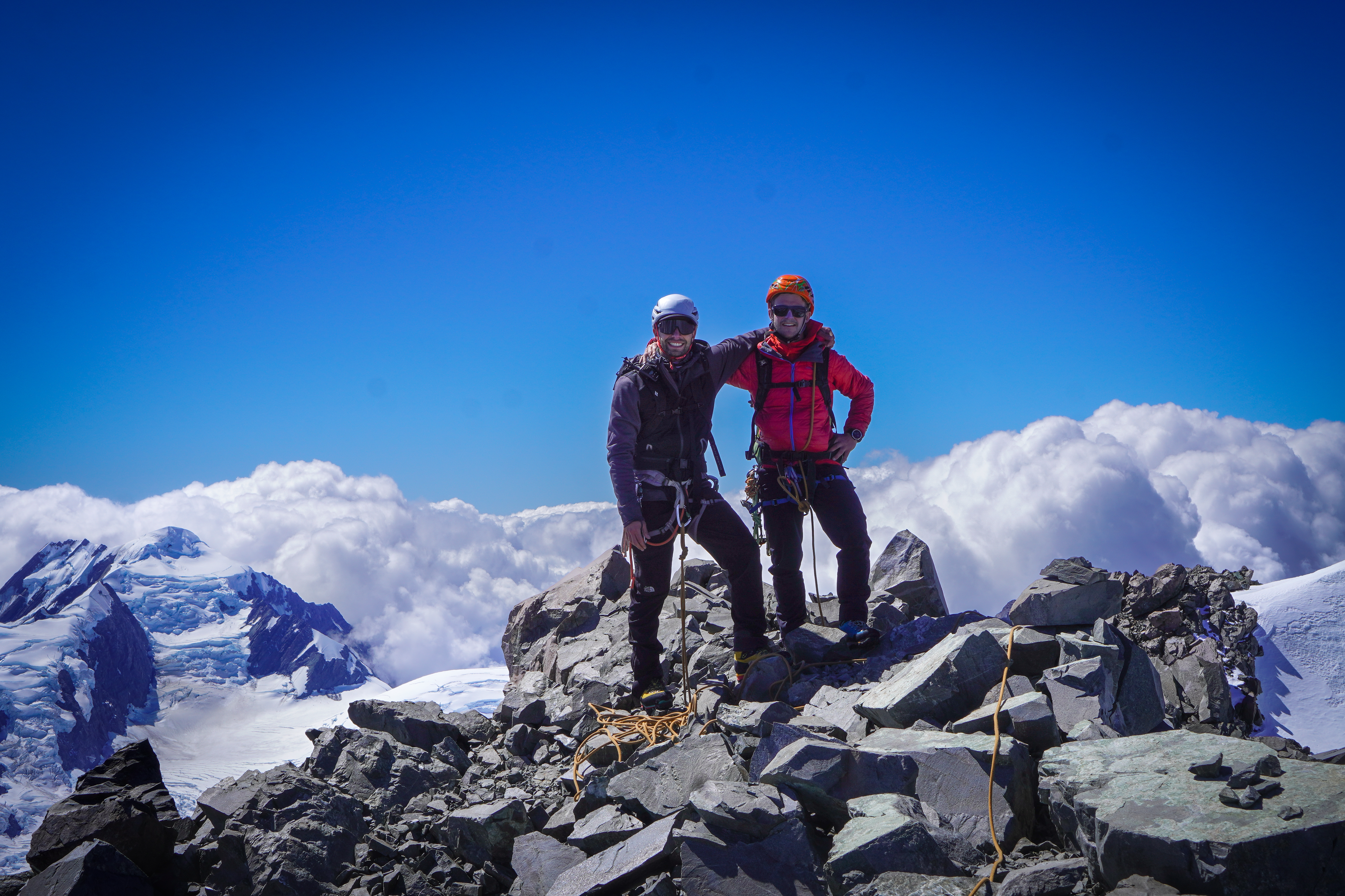
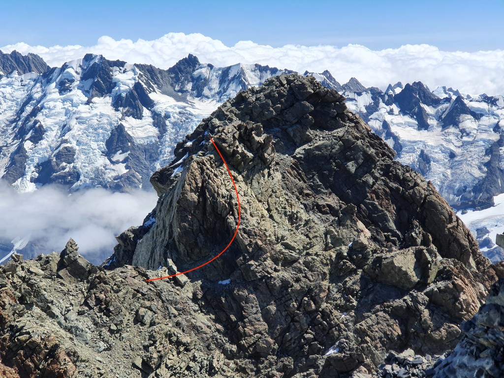
It gets easier from here up to the summit but took a surprisingly long time as we took the rope on and off a few times and needed to make 1x rap: it took us nearly 2 hours from the cheval to the summit. The route finding wasn’t super obvious at one point on the way up passing one final gendarme – we made an unnecessary rap down the south face and then climbed back up a snow field. When viewed from above you can easily turn the gendarme on the north side (see pic below!).
To descend, there are multiple spikes to rap from to get you back to the cheval, which is likely a faster option depending on how confident your down climbing is. Once you’re back across the cheval, 10x 30m raps on DBAs gets you back to where you started. Lots of loose blocks around so be careful of rockfall. Would advise against 60m raps, high chance of getting the rope stuck.
We were moving pretty slowly and were around 12 hours camp to camp but with a bit of simulclimbing, you could expect that to be a fair bit faster. But don’t underestimate how long the final ridge can take, more than one group has spent a night on the route!